Bismarck night lights from space
Night Light of Bismarck (North Dakota) from space (United States) Src. Average luminocity for 10x10km area is 79.2411% and for 50x50km: 6.3132%.
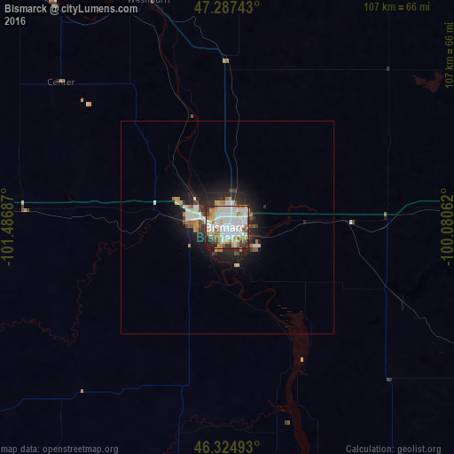
Analysis of Bismarck night lights 2016
Square area 10x10 km:
 27.08%
90-99
27.38%80-89
6.7%70-79
7.74%60-69
6.7%50-59
6.99%40-49
5.8%30-39
5.95%20-29
4.91%10-19
0.74%0-9
0%Square area 50x50 km:
1.44%90-99
1.49%80-89
0.5%70-79
0.6%60-69
0.61%50-59
0.63%40-49
0.46%30-39
0.83%20-29
1.93%10-19
3.86%0-9
87.66%Clear (daylight) street map image can be seen on geolist.org.
Map coordinates:
47° 17' 14.7" North, 101° 29' 12.7" West
46° 48' 30" North, 100° 47' 1.5" West
46° 19' 29.7" North, 100° 4' 50.2" West
Some cities around Bismarck sort by population:
• Minot
163 km =101.3 mi,  346°
346°
• Dickinson
152.8 km =94.9 mi,  272°
272°
• Mandan
8.3 km =5.2 mi,  284°
284°
• Jamestown
158.2 km =98.3 mi,  85°
85°
• Devils Lake
204.5 km =127.1 mi,  44°
44°
• Watford City
218.5 km =135.8 mi,  300°
300°
• Valley City
211.8 km =131.6 mi, 86°
• Minot Air Force Base
184.1 km =114.4 mi, 346°
5688025 (p: 71,167)
Sources (retrieved 2019-11-25):
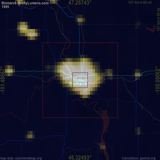
» NASA, Earths city lights 1995
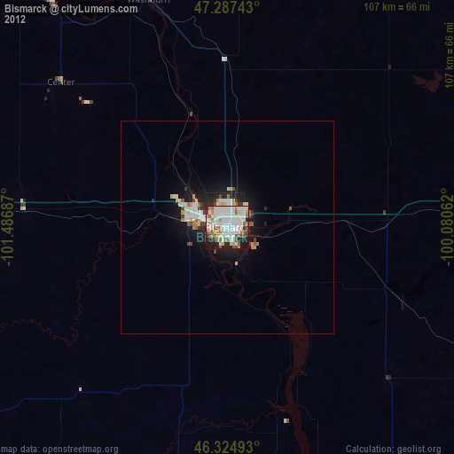
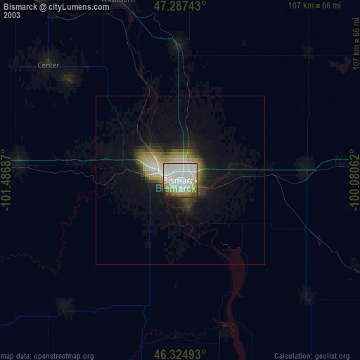
» NASA city lights 2003
» Earth at Night: Flat Maps 2012, 2016