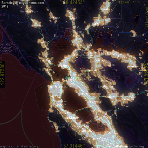
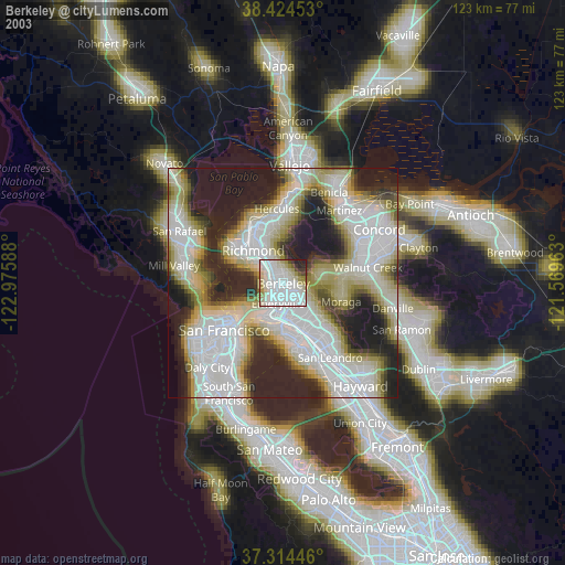
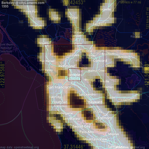
Berkeley night lights from space
Night Light of Berkeley (California) from space (United States) Src. Average luminocity for 10x10km area is 68.1445% and for 50x50km: 45.3389%.
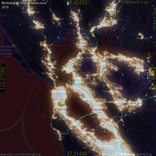
Analysis of Berkeley night lights 2016
Square area 10x10 km:
 18.02%
90-99
18.67%80-89
5.19%70-79
7.47%60-69
9.9%50-59
12.5%40-49
6.98%30-39
8.28%20-29
9.58%10-19
3.41%0-9
0%Square area 50x50 km:
10.63%90-99
9.14%80-89
2.59%70-79
5.3%60-69
6.32%50-59
7.01%40-49
7.24%30-39
6.71%20-29
13.07%10-19
17.45%0-9
14.54%Clear (daylight) street map image can be seen on geolist.org.
Map coordinates:
38° 25' 28.3" North, 122° 58' 33.2" West
37° 52' 17.7" North, 122° 16' 21.9" West
37° 18' 52.1" North, 121° 34' 10.7" West
Some cities around Berkeley sort by population:
• Oakland
7.5 km =4.7 mi,  178°
178°
• Richmond
9.7 km =6 mi,  317°
317°
• El Cerrito
6 km =3.7 mi,  325°
325°
• Albany
2.8 km =1.7 mi,  307°
307°
• Orinda
8.2 km =5.1 mi,  85°
85°
• Emeryville
4.6 km =2.9 mi,  193°
193°
• Piedmont
6.4 km =4 mi,  145°
145°
• Kensington
4.4 km =2.7 mi,  351°
351°
5327684 (p: 120,972)
Sources (retrieved 2019-11-25):
» NASA, Earths city lights 1995
» NASA city lights 2003
» Earth at Night: Flat Maps 2012, 2016