Kensington night lights from space
Night Light of Kensington (California) from space (United States) Src. Average luminocity for 10x10km area is 54.7224% and for 50x50km: 42.9563%.
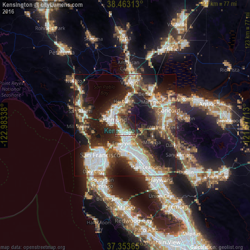
Analysis of Kensington night lights 2016
Square area 10x10 km:
 11.36%
90-99
13.15%80-89
4.06%70-79
5.84%60-69
4.55%50-59
12.66%40-49
7.31%30-39
12.66%20-29
14.61%10-19
11.2%0-9
2.6%Square area 50x50 km:
10.05%90-99
8.34%80-89
2.55%70-79
4.91%60-69
5.81%50-59
6.76%40-49
7.23%30-39
6.45%20-29
12.38%10-19
17.44%0-9
18.08%Clear (daylight) street map image can be seen on geolist.org.
Map coordinates:
38° 27' 47.3" North, 122° 59' 0.2" West
37° 54' 37.7" North, 122° 16' 48.9" West
37° 21' 13.1" North, 121° 34' 37.7" West
Some cities around Kensington sort by population:
• Berkeley
4.4 km =2.7 mi,  171°
171°
• Richmond
6.6 km =4.1 mi,  295°
295°
• San Pablo
8.1 km =5 mi,  315°
315°
• El Cerrito
2.8 km =1.7 mi,  282°
282°
• Albany
3 km =1.9 mi,  210°
210°
• Orinda
9.6 km =6 mi,  112°
112°
• El Sobrante
7.5 km =4.7 mi,  349°
349°
• Emeryville
8.8 km =5.5 mi,  182°
182°
5362849 (p: 5,077)
Sources (retrieved 2019-11-25):
» Earth at Night: Flat Maps 2012, 2016