Piedmont night lights from space
Night Light of Piedmont (California) from space (United States) Src. Average luminocity for 10x10km area is 79.6259% and for 50x50km: 47.2401%.
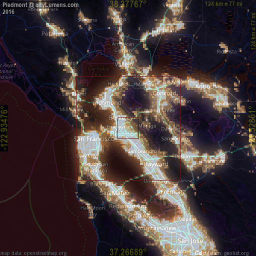
Analysis of Piedmont night lights 2016
Square area 10x10 km:
 29.93%
90-99
25.51%80-89
4.25%70-79
5.95%60-69
10.03%50-59
8.67%40-49
6.12%30-39
3.06%20-29
6.46%10-19
0%0-9
0%Square area 50x50 km:
11.43%90-99
9.71%80-89
2.44%70-79
5.36%60-69
6.5%50-59
7.38%40-49
7.36%30-39
6.77%20-29
14.1%10-19
17.73%0-9
11.22%Clear (daylight) street map image can be seen on geolist.org.
Map coordinates:
38° 22' 39.6" North, 122° 56' 5.1" West
37° 49' 27.7" North, 122° 13' 53.9" West
37° 16' 0.8" North, 121° 31' 42.6" West
Some cities around Piedmont sort by population:
• Oakland
4.1 km =2.5 mi,  237°
237°
• Berkeley
6.4 km =4 mi,  325°
325°
• Alameda
6.6 km =4.1 mi,  187°
187°
• Albany
9.1 km =5.7 mi,  320°
320°
• Orinda
7.4 km =4.6 mi,  37°
37°
• Moraga
9 km =5.6 mi,  82°
82°
• Emeryville
4.8 km =3 mi,  279°
279°
• Kensington
10.5 km =6.5 mi,  335°
335°
5382514 (p: 11,376)
Sources (retrieved 2019-11-25):
» Earth at Night: Flat Maps 2012, 2016