Falcon Heights night lights from space
Night Light of Falcon Heights (Minnesota) from space (United States) Src. Average luminocity for 10x10km area is 93.9556% and for 50x50km: 64.552%.
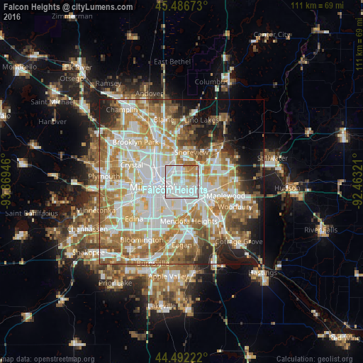
Analysis of Falcon Heights night lights 2016
Square area 10x10 km:
 46.98%
90-99
29.68%80-89
9.05%70-79
9.84%60-69
4.13%50-59
0.32%40-49
0%30-39
0%20-29
0%10-19
0%0-9
0%Square area 50x50 km:
18.49%90-99
15.66%80-89
7.44%70-79
8.73%60-69
12.55%50-59
7.27%40-49
5.15%30-39
3.08%20-29
5.3%10-19
7.35%0-9
8.97%Clear (daylight) street map image can be seen on geolist.org.
Map coordinates:
45° 29' 12.2" North, 93° 52' 10.1" West
44° 59' 29.9" North, 93° 9' 58.8" West
44° 29' 32" North, 92° 27' 47.6" West
Some cities around Falcon Heights sort by population:
• Minneapolis
7.8 km =4.8 mi,  260°
260°
• Saint Paul
7.8 km =4.8 mi,  132°
132°
• Roseville
1.8 km =1.1 mi,  25°
25°
• New Brighton
8.7 km =5.4 mi,  341°
341°
• Columbia Heights
9.4 km =5.8 mi,  305°
305°
• Little Canada
7.3 km =4.5 mi,  57°
57°
• Arden Hills
6.6 km =4.1 mi,  6°
6°
• Saint Anthony
5.2 km =3.2 mi, 308°
5026251 (p: 5,571)
Sources (retrieved 2019-11-25):
» Earth at Night: Flat Maps 2012, 2016