Ann Arbor night lights from space
Night Light of Ann Arbor (Michigan) from space (United States) Src. Average luminocity for 10x10km area is 77.8833% and for 50x50km: 25.8772%.
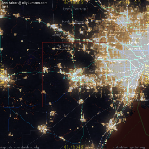

Analysis of Ann Arbor night lights 2016
Square area 10x10 km:
 21.97%
90-99
21.06%80-89
13.94%70-79
10.76%60-69
11.82%50-59
4.24%40-49
6.52%30-39
4.85%20-29
4.24%10-19
0.61%0-9
0%Square area 50x50 km:
3.22%90-99
4.3%80-89
3.27%70-79
3.69%60-69
5.28%50-59
4.74%40-49
3.82%30-39
3.08%20-29
6.86%10-19
10.65%0-9
51.09%Clear (daylight) street map image can be seen on geolist.org.
Map coordinates:
42° 47' 44.3" North, 84° 26' 38.4" West
42° 16' 39.2" North, 83° 44' 27.2" West
41° 45' 18.6" North, 83° 2' 15.9" West
Some cities around Ann Arbor sort by population:
• Canton
21.6 km =13.4 mi,  80°
80°
• Ypsilanti
11.3 km =7 mi,  111°
111°
• South Lyon
21.6 km =13.4 mi,  19°
19°
• Saline
12.8 km =8 mi,  195°
195°
• Plymouth
24.6 km =15.3 mi,  64°
64°
• Whitmore Lake
18 km =11.2 mi,  358°
358°
• Milan
21.9 km =13.6 mi,  167°
167°
• Chelsea
23.5 km =14.6 mi,  281°
281°
4984247 (p: 117,070)
Sources (retrieved 2019-11-25):
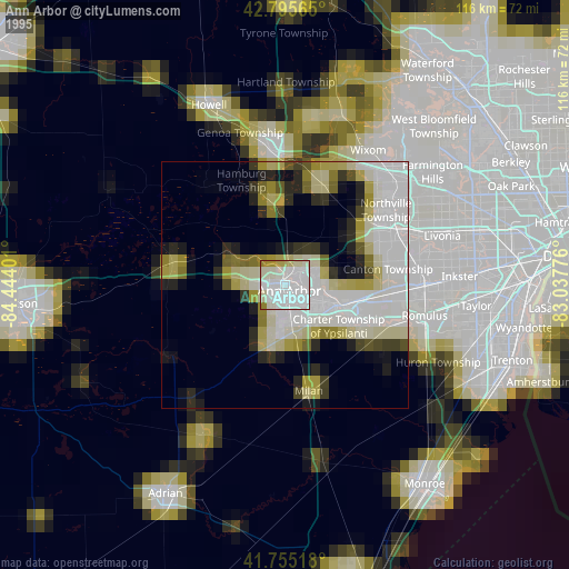
» NASA, Earths city lights 1995
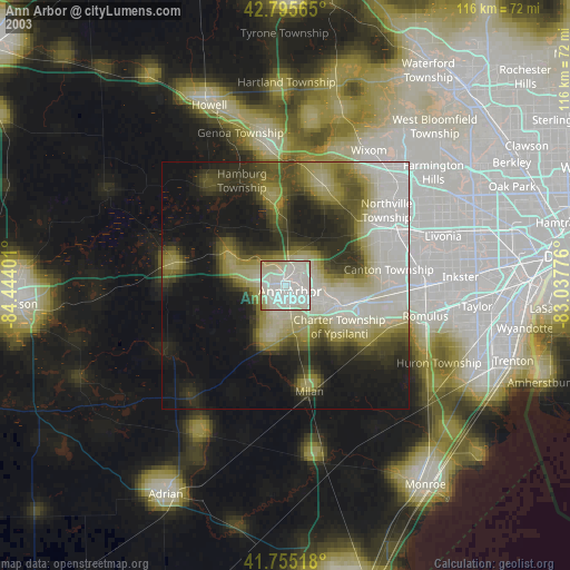
» NASA city lights 2003
» Earth at Night: Flat Maps 2012, 2016