Chelsea night lights from space
Night Light of Chelsea (Michigan) from space (United States) Src. Average luminocity for 10x10km area is 14.6485% and for 50x50km: 9.4184%.
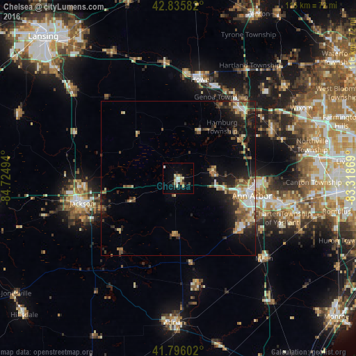
Analysis of Chelsea night lights 2016
Square area 10x10 km:
 2.12%
2.12%90-99
2.42%80-89
3.03%70-79
1.21%60-69
1.06%50-59
1.67%40-49
1.21%30-39
0.61%20-29
3.03%10-19
3.48%0-9
80.15%Square area 50x50 km:
1.19%90-99
1.31%80-89
1.24%70-79
0.94%60-69
1.48%50-59
1.25%40-49
1.57%30-39
1.24%20-29
2.95%10-19
6.04%0-9
80.8%Clear (daylight) street map image can be seen on geolist.org.
Map coordinates:
42° 50' 9" North, 84° 43' 29.8" West
42° 19' 5.1" North, 84° 1' 18.5" West
41° 47' 45.7" North, 83° 19' 7.3" West
Some cities around Chelsea sort by population:
• Ann Arbor
23.5 km =14.6 mi,  101°
101°
• Jackson
32.2 km =20 mi,  255°
255°
• Ypsilanti
34.7 km =21.6 mi, 104°
• South Lyon
34.3 km =21.3 mi,  62°
62°
• Howell
33 km =20.5 mi,  13°
13°
• Saline
26 km =16.2 mi,  130°
130°
• Brighton
30.8 km =19.1 mi,  40°
40°
• Whitmore Lake
26.4 km =16.4 mi, 59°
4988628 (p: 5,205)
Sources (retrieved 2019-11-25):
» Earth at Night: Flat Maps 2012, 2016