Saline night lights from space
Night Light of Saline (Michigan) from space (United States) Src. Average luminocity for 10x10km area is 29.8818% and for 50x50km: 18.6922%.
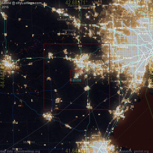
Analysis of Saline night lights 2016
Square area 10x10 km:
 3.03%
3.03%90-99
3.18%80-89
4.39%70-79
5.45%60-69
4.09%50-59
3.18%40-49
7.88%30-39
3.18%20-29
8.64%10-19
23.33%0-9
33.64%Square area 50x50 km:
2.29%90-99
3.22%80-89
2.38%70-79
2.15%60-69
3.37%50-59
3.64%40-49
2.99%30-39
2.25%20-29
4.89%10-19
7.19%0-9
65.63%Clear (daylight) street map image can be seen on geolist.org.
Map coordinates:
42° 41' 8.6" North, 84° 29' 5.1" West
42° 10' 0.2" North, 83° 46' 53.8" West
41° 38' 36.3" North, 83° 4' 42.6" West
Some cities around Saline sort by population:
• Ann Arbor
12.8 km =8 mi,  15°
15°
• Canton
29.3 km =18.2 mi,  57°
57°
• Romulus
32.3 km =20.1 mi,  78°
78°
• Ypsilanti
16.2 km =10.1 mi, 59°
• Tecumseh
22.6 km =14 mi,  216°
216°
• Whitmore Lake
30.5 km =19 mi,  5°
5°
• Milan
12.2 km =7.6 mi,  137°
137°
• Chelsea
26 km =16.2 mi,  310°
310°
5008768 (p: 9,100)
Sources (retrieved 2019-11-25):
» Earth at Night: Flat Maps 2012, 2016