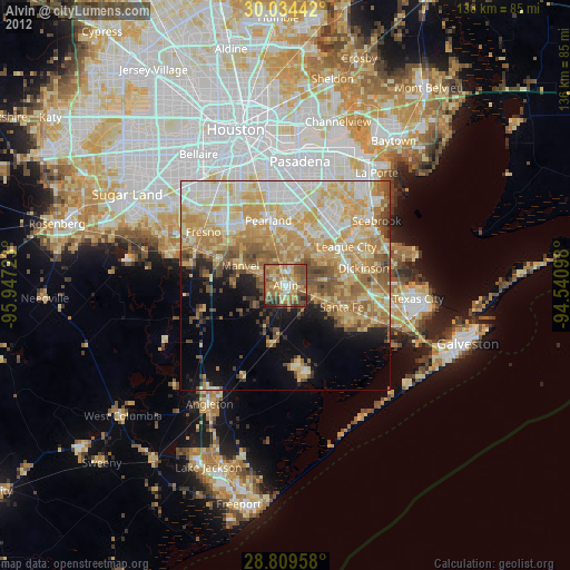
Alvin night lights from space
Night Light of Alvin (Texas) from space (United States) Src. Average luminocity for 10x10km area is 57.3409% and for 50x50km: 46.043%.
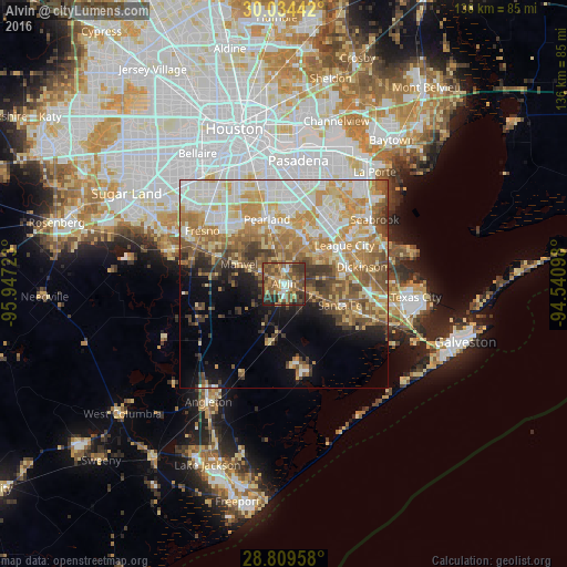
Analysis of Alvin night lights 2016
Square area 10x10 km:
 4.17%
4.17%90-99
7.01%80-89
2.84%70-79
12.12%60-69
14.77%50-59
21.78%40-49
16.1%30-39
14.02%20-29
6.25%10-19
0.95%0-9
0%Square area 50x50 km:
8.18%90-99
9.99%80-89
7.23%70-79
8.97%60-69
7.71%50-59
7.04%40-49
5.44%30-39
4.84%20-29
3.1%10-19
6.26%0-9
31.24%Clear (daylight) street map image can be seen on geolist.org.
Map coordinates:
30° 2' 3.9" North, 95° 56' 50" West
29° 25' 25.9" North, 95° 14' 38.8" West
28° 48' 34.5" North, 94° 32' 27.5" West
Some cities around Alvin sort by population:
• Pearland
16.1 km =10 mi,  345°
345°
• League City
17.2 km =10.7 mi,  57°
57°
• Friendswood
12.5 km =7.8 mi,  19°
19°
• Dickinson
19.1 km =11.9 mi,  77°
77°
• Fresno
23.5 km =14.6 mi,  303°
303°
• Santa Fe
14.3 km =8.9 mi,  110°
110°
• Webster
17.6 km =10.9 mi,  43°
43°
• Manvel
11.8 km =7.3 mi,  291°
291°
4670592 (p: 25,791)
Sources (retrieved 2019-11-25):
» Earth at Night: Flat Maps 2012, 2016