Albemarle night lights from space
Night Light of Albemarle (North Carolina) from space (United States) Src. Average luminocity for 10x10km area is 40.9487% and for 50x50km: 6.9366%.
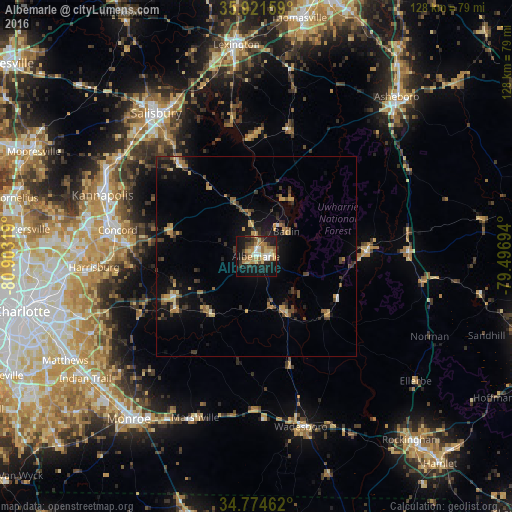
Analysis of Albemarle night lights 2016
Square area 10x10 km:
 3.3%
3.3%90-99
4.95%80-89
9.71%70-79
5.86%60-69
10.44%50-59
3.85%40-49
4.95%30-39
6.04%20-29
9.34%10-19
34.25%0-9
7.33%Square area 50x50 km:
0.23%90-99
0.35%80-89
1.11%70-79
1.08%60-69
1.2%50-59
0.77%40-49
1.24%30-39
1.68%20-29
1.7%10-19
5.18%0-9
85.46%Clear (daylight) street map image can be seen on geolist.org.
Map coordinates:
35° 55' 17.7" North, 80° 54' 11.5" West
35° 21' 0.5" North, 80° 12' 0.2" West
34° 46' 28.6" North, 79° 29' 49" West
Some cities around Albemarle sort by population:
• Concord
35.2 km =21.9 mi,  280°
280°
• Kannapolis
41.1 km =25.5 mi,  291°
291°
• Monroe
51.5 km =32 mi,  218°
218°
• Salisbury
43.5 km =27 mi,  325°
325°
• Mint Hill
44.8 km =27.8 mi,  244°
244°
• Harrisburg
41.6 km =25.8 mi,  265°
265°
• Unionville
40.5 km =25.2 mi, 223°
• Wadesboro
43.9 km =27.3 mi,  165°
165°
4452303 (p: 16,003)
Sources (retrieved 2019-11-25):
» Earth at Night: Flat Maps 2012, 2016