Unionville night lights from space
Night Light of Unionville (North Carolina) from space (United States) Src. Average luminocity for 10x10km area is 15.2745% and for 50x50km: 30.5431%.
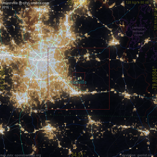
Analysis of Unionville night lights 2016
Square area 10x10 km:
 0%
0%90-99
0%80-89
1.4%70-79
0.87%60-69
0.87%50-59
1.75%40-49
1.92%30-39
11.19%20-29
11.36%10-19
19.41%0-9
51.22%Square area 50x50 km:
4.32%90-99
4.54%80-89
6.46%70-79
6.05%60-69
6.6%50-59
2.71%40-49
3.3%30-39
3.66%20-29
5.11%10-19
8.72%0-9
48.53%Clear (daylight) street map image can be seen on geolist.org.
Map coordinates:
35° 39' 38.5" North, 81° 12' 43.5" West
35° 5' 14.5" North, 80° 30' 32.3" West
34° 30' 36" North, 79° 48' 21" West
Some cities around Unionville sort by population:
• Indian Trail
14.6 km =9.1 mi,  265°
265°
• Monroe
11.9 km =7.4 mi,  198°
198°
• Matthews
19.8 km =12.3 mi,  279°
279°
• Mint Hill
16.2 km =10.1 mi,  309°
309°
• Stallings
16.1 km =10 mi, 271°
• Waxhaw
28 km =17.4 mi,  229°
229°
• Weddington
24 km =14.9 mi,  252°
252°
• Wesley Chapel
17.5 km =10.9 mi,  239°
239°
4496304 (p: 6,547)
Sources (retrieved 2019-11-25):
» Earth at Night: Flat Maps 2012, 2016