Alafaya night lights from space
Night Light of Alafaya (Florida) from space (United States) Src. Average luminocity for 10x10km area is 93.3674% and for 50x50km: 51.8079%.
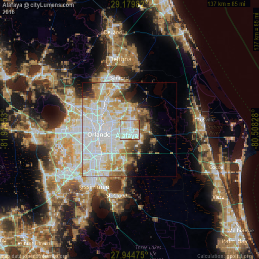
Analysis of Alafaya night lights 2016
Square area 10x10 km:
 35.42%
90-99
39.58%80-89
12.69%70-79
8.71%60-69
3.03%50-59
0.57%40-49
0%30-39
0%20-29
0%10-19
0%0-9
0%Square area 50x50 km:
17.27%90-99
15.75%80-89
5.77%70-79
6.59%60-69
6.37%50-59
2.59%40-49
2.6%30-39
2.43%20-29
3.39%10-19
5.03%0-9
32.21%Clear (daylight) street map image can be seen on geolist.org.
Map coordinates:
29° 10' 47.4" North, 81° 54' 52.3" West
28° 33' 50.8" North, 81° 12' 41" West
27° 56' 41.1" North, 80° 30' 29.8" West
Some cities around Alafaya sort by population:
• Oviedo
11.8 km =7.3 mi,  1°
1°
• Winter Park
13.1 km =8.1 mi,  287°
287°
• Conway
13.5 km =8.4 mi,  239°
239°
• Azalea Park
9.1 km =5.7 mi,  253°
253°
• Goldenrod
9.1 km =5.7 mi,  304°
304°
• Union Park
7.3 km =4.5 mi,  273°
273°
• Bithlo
10.3 km =6.4 mi,  95°
95°
• Wedgefield
15.6 km =9.7 mi,  122°
122°
6332439 (p: 78,113)
Sources (retrieved 2019-11-25):
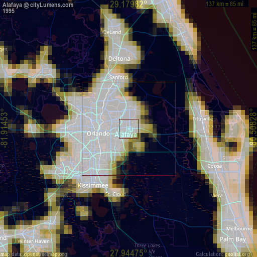
» NASA, Earths city lights 1995
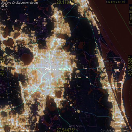
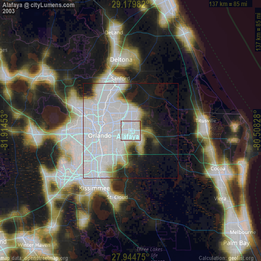
» NASA city lights 2003
» Earth at Night: Flat Maps 2012, 2016