Conway night lights from space
Night Light of Conway (Florida) from space (United States) Src. Average luminocity for 10x10km area is 96.9365% and for 50x50km: 71.4417%.
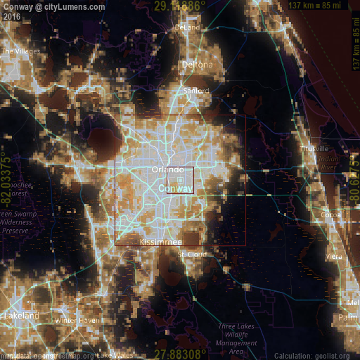
Analysis of Conway night lights 2016
Square area 10x10 km:
 55.95%
90-99
31.75%80-89
11.51%70-79
0.79%60-69
0%50-59
0%40-49
0%30-39
0%20-29
0%10-19
0%0-9
0%Square area 50x50 km:
23.26%90-99
21.89%80-89
9.34%70-79
10.11%60-69
7.96%50-59
3.71%40-49
3.05%30-39
3.7%20-29
3.56%10-19
4.11%0-9
9.32%Clear (daylight) street map image can be seen on geolist.org.
Map coordinates:
29° 7' 7.9" North, 82° 2' 1.5" West
28° 30' 10" North, 81° 19' 50.2" West
27° 52' 59.1" North, 80° 37' 39" West
Some cities around Conway sort by population:
• Orlando
6.2 km =3.9 mi,  309°
309°
• Winter Park
10.8 km =6.7 mi,  355°
355°
• Oak Ridge
9.8 km =6.1 mi,  249°
249°
• Azalea Park
5.2 km =3.2 mi,  34°
34°
• Pine Castle
5 km =3.1 mi,  226°
226°
• Union Park
8.5 km =5.3 mi, 30°
• Belle Isle
5.7 km =3.5 mi,  209°
209°
• Sky Lake
7.8 km =4.8 mi, 229°
4151745 (p: 13,467)
Sources (retrieved 2019-11-25):
» Earth at Night: Flat Maps 2012, 2016