Prymors’k night lights from space
Night Light of Prymors’k (Zaporizhia) from space (Ukraine) Src. Average luminocity for 10x10km area is 0.7976% and for 50x50km: 0.0327%.
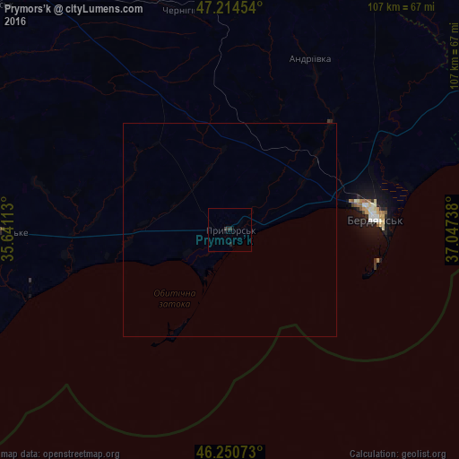
Analysis of Prymors’k night lights 2016
Square area 10x10 km:
 0%
0%90-99
0%80-89
0%70-79
0%60-69
0%50-59
0%40-49
0%30-39
1.19%20-29
0.74%10-19
0.45%0-9
97.62%Square area 50x50 km:
0%90-99
0%80-89
0%70-79
0%60-69
0%50-59
0%40-49
0%30-39
0.05%20-29
0.03%10-19
0.02%0-9
99.91%Clear (daylight) street map image can be seen on geolist.org.
Map coordinates:
47° 12' 52.3" North, 35° 38' 28.1" East
46° 44' 5.2" North, 36° 20' 39.3" East
46° 15' 2.6" North, 37° 2' 50.6" East
Some cities around Prymors’k sort by population:
• Melitopol
75.6 km =47 mi,  279°
279°
• Berdyansk
34.8 km =21.6 mi,  84°
84°
• Tokmak
75.1 km =46.7 mi,  320°
320°
• Polohy
83.6 km =51.9 mi,  355°
355°
• Kostyantynivka
70.8 km =44 mi, 277°
• Manhush
81.6 km =50.7 mi,  64°
64°
• Kuybysheve
73 km =45.4 mi,  18°
18°
• Yalta
75.1 km =46.7 mi,  70°
70°
696292 (p: 13,900)
Sources (retrieved 2019-11-25):
» Earth at Night: Flat Maps 2012, 2016