Piskivka night lights from space
Night Light of Piskivka (Kyiv) from space (Ukraine) Src. Average luminocity for 10x10km area is 0.4198% and for 50x50km: 0.1991%.
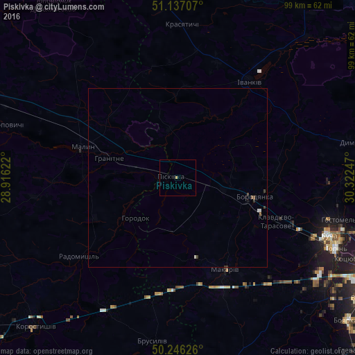
Analysis of Piskivka night lights 2016
Square area 10x10 km:
 0%
0%90-99
0%80-89
0%70-79
0.53%60-69
0%50-59
0%40-49
0%30-39
0%20-29
0%10-19
0%0-9
99.47%Square area 50x50 km:
0.03%90-99
0.04%80-89
0%70-79
0.02%60-69
0%50-59
0.07%40-49
0.04%30-39
0.09%20-29
0%10-19
0.04%0-9
99.67%Clear (daylight) street map image can be seen on geolist.org.
Map coordinates:
51° 8' 13.5" North, 28° 54' 58.4" East
50° 41' 37.6" North, 29° 37' 9.6" East
50° 14' 46.5" North, 30° 19' 20.9" East
Some cities around Piskivka sort by population:
• Bucha
45 km =28 mi,  111°
111°
• Malyn
28.2 km =17.5 mi,  288°
288°
• Radomyshl
35.2 km =21.9 mi,  231°
231°
• Borodianka
21.9 km =13.6 mi,  104°
104°
• Makariv
28.9 km =18 mi,  152°
152°
• Ivankiv
33.4 km =20.8 mi,  35°
35°
• Vorzel’
41.2 km =25.6 mi, 113°
• Stavyshche
33.2 km =20.6 mi,  191°
191°
697489 (p: 6,889)
Sources (retrieved 2019-11-25):
» Earth at Night: Flat Maps 2012, 2016