Bucha night lights from space
Night Light of Bucha (Kyiv) from space (Ukraine) Src. Average luminocity for 10x10km area is 37.0762% and for 50x50km: 17.8067%.
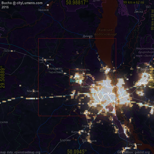
Analysis of Bucha night lights 2016
Square area 10x10 km:
 4.14%
4.14%90-99
6.82%80-89
6.15%70-79
4.95%60-69
5.35%50-59
5.61%40-49
4.81%30-39
3.07%20-29
9.76%10-19
31.42%0-9
17.91%Square area 50x50 km:
4.82%90-99
3.77%80-89
1.36%70-79
1.88%60-69
1.87%50-59
2.11%40-49
2.22%30-39
2.31%20-29
4.08%10-19
8.07%0-9
67.51%Clear (daylight) street map image can be seen on geolist.org.
Map coordinates:
50° 59' 17.4" North, 29° 30' 32" East
50° 32' 36.4" North, 30° 12' 43.2" East
50° 5' 40.2" North, 30° 54' 54.5" East
Some cities around Bucha sort by population:
• Irpin
3.6 km =2.2 mi,  131°
131°
• Vyshhorod
20.2 km =12.6 mi,  76°
76°
• Kotsyubyns’ke
10.3 km =6.4 mi, 126°
• Hostomel
4.7 km =2.9 mi,  53°
53°
• Vorzel’
4.2 km =2.6 mi,  271°
271°
• Novi Petrivtsi
18.8 km =11.7 mi,  60°
60°
• Sofiyivska Borschagivka
18.5 km =11.5 mi,  143°
143°
• Horenka
8.6 km =5.3 mi, 79°
711350 (p: 42,279)
Sources (retrieved 2019-11-25):
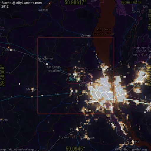
» Earth at Night: Flat Maps 2012, 2016