Komyshuvakha night lights from space
Night Light of Komyshuvakha (Zaporizhia) from space (Ukraine) Src. Average luminocity for 10x10km area is 0.5387% and for 50x50km: 3.0289%.
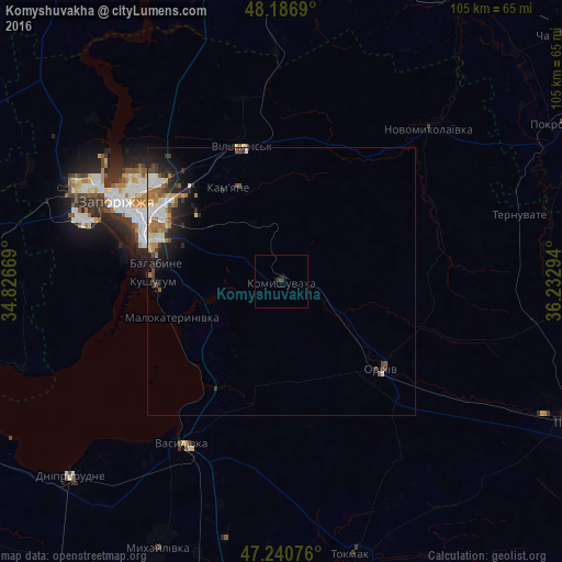
Analysis of Komyshuvakha night lights 2016
Square area 10x10 km:
 0%
0%90-99
0%80-89
0%70-79
0%60-69
0%50-59
0%40-49
0%30-39
1.19%20-29
0%10-19
0.6%0-9
98.21%Square area 50x50 km:
0.43%90-99
0.53%80-89
0.3%70-79
0.33%60-69
0.57%50-59
0.45%40-49
0.37%30-39
0.47%20-29
0.97%10-19
1.78%0-9
93.79%Clear (daylight) street map image can be seen on geolist.org.
Map coordinates:
48° 11' 12.8" North, 34° 49' 36.1" East
47° 42' 57.5" North, 35° 31' 47.3" East
47° 14' 26.7" North, 36° 13' 58.6" East
Some cities around Komyshuvakha sort by population:
• Zaporizhia
28 km =17.4 mi,  295°
295°
• Tokmak
53 km =32.9 mi,  165°
165°
• Orikhiv
25.3 km =15.7 mi,  130°
130°
• Vasylivka
36.5 km =22.7 mi,  211°
211°
• Mykhaylivka
54.5 km =33.9 mi, 205°
• Kushuhum
24 km =14.9 mi,  269°
269°
• Novomykolayivka
40.7 km =25.3 mi,  44°
44°
• Vil’ne
54.3 km =33.7 mi,  260°
260°
706941 (p: 5,231)
Sources (retrieved 2019-11-25):
» Earth at Night: Flat Maps 2012, 2016