Kushuhum night lights from space
Night Light of Kushuhum (Zaporizhia) from space (Ukraine) Src. Average luminocity for 10x10km area is 5.0461% and for 50x50km: 8.3967%.
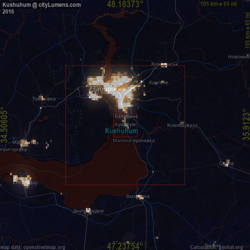
Analysis of Kushuhum night lights 2016
Square area 10x10 km:
 0%
0%90-99
0%80-89
0%70-79
0%60-69
0.6%50-59
0.6%40-49
1.79%30-39
0.6%20-29
1.19%10-19
11.61%0-9
83.63%Square area 50x50 km:
1.61%90-99
1.88%80-89
0.68%70-79
0.96%60-69
1.07%50-59
1.02%40-49
0.79%30-39
1.26%20-29
2.78%10-19
4.73%0-9
83.22%Clear (daylight) street map image can be seen on geolist.org.
Map coordinates:
48° 11' 1.4" North, 34° 30' 21.8" East
47° 42' 46" North, 35° 12' 33" East
47° 14' 15.1" North, 35° 54' 44.3" East
Some cities around Kushuhum sort by population:
• Zaporizhia
12.3 km =7.6 mi,  353°
353°
• Marhanets’
44.4 km =27.6 mi,  258°
258°
• Dniprorudne
40.7 km =25.3 mi,  205°
205°
• Vasylivka
31.1 km =19.3 mi,  170°
170°
• Tomakivka
36.8 km =22.9 mi,  288°
288°
• Balky
41.7 km =25.9 mi, 208°
• Vil’ne
30.8 km =19.1 mi,  253°
253°
• Komyshuvakha
24 km =14.9 mi,  89°
89°
703555 (p: 7,475)
Sources (retrieved 2019-11-25):
» Earth at Night: Flat Maps 2012, 2016