Vil’ne night lights from space
Night Light of Vil’ne (Dnipropetrovsk) from space (Ukraine) Src. Average luminocity for 10x10km area is 1.2009% and for 50x50km: 3.3571%.
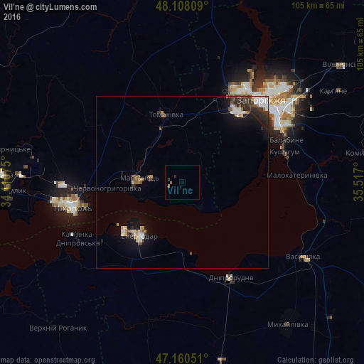
Analysis of Vil’ne night lights 2016
Square area 10x10 km:
 0%
0%90-99
0%80-89
0%70-79
0%60-69
0.6%50-59
0.6%40-49
0%30-39
0.6%20-29
0.6%10-19
0%0-9
97.62%Square area 50x50 km:
0.61%90-99
0.54%80-89
0.16%70-79
0.39%60-69
0.3%50-59
0.45%40-49
0.39%30-39
0.67%20-29
0.96%10-19
2.41%0-9
93.13%Clear (daylight) street map image can be seen on geolist.org.
Map coordinates:
48° 6' 29.1" North, 34° 6' 38.7" East
47° 38' 11.2" North, 34° 48' 49.9" East
47° 9' 37.8" North, 35° 31' 1.2" East
Some cities around Vil’ne sort by population:
• Energodar
19.3 km =12 mi,  217°
217°
• Marhanets’
13.9 km =8.6 mi,  269°
269°
• Dniprorudne
30.8 km =19.1 mi,  156°
156°
• Tomakivka
20.7 km =12.9 mi,  344°
344°
• Kushuhum
30.8 km =19.1 mi,  73°
73°
• Chervonohryhorivka
20.7 km =12.9 mi, 265°
• Balky
29.8 km =18.5 mi, 160°
• Vodyane
29.3 km =18.2 mi,  235°
235°
689190 (p: 5,432)
Sources (retrieved 2019-11-25):
» Earth at Night: Flat Maps 2012, 2016