Mykhaylivka night lights from space
Night Light of Mykhaylivka (Zaporizhia) from space (Ukraine) Src. Average luminocity for 10x10km area is 0.4539% and for 50x50km: 0.4521%.
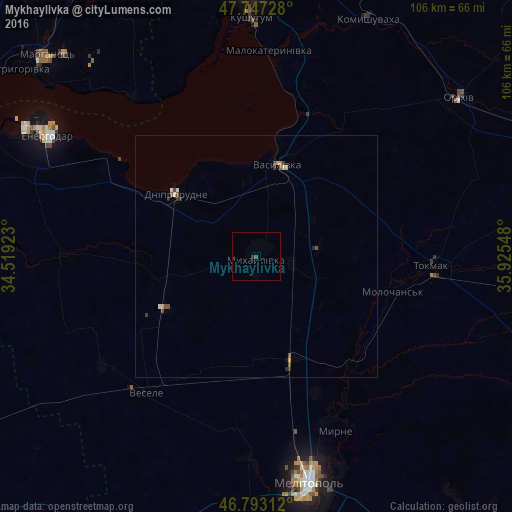
Analysis of Mykhaylivka night lights 2016
Square area 10x10 km:
 0%
0%90-99
0%80-89
0%70-79
0%60-69
0%50-59
0%40-49
0.3%30-39
0.3%20-29
0.6%10-19
0%0-9
98.81%Square area 50x50 km:
0.02%90-99
0.08%80-89
0.02%70-79
0.11%60-69
0.01%50-59
0.06%40-49
0.21%30-39
0.1%20-29
0.13%10-19
0.02%0-9
99.25%Clear (daylight) street map image can be seen on geolist.org.
Map coordinates:
47° 44' 50.2" North, 34° 31' 9.2" East
47° 16' 20.5" North, 35° 13' 20.5" East
46° 47' 35.2" North, 35° 55' 31.7" East
Some cities around Mykhaylivka sort by population:
• Melitopol
48.3 km =30 mi,  167°
167°
• Tokmak
37 km =23 mi,  92°
92°
• Dniprorudne
22.2 km =13.8 mi,  303°
303°
• Vasylivka
18.7 km =11.6 mi,  12°
12°
• Vesele
36.9 km =22.9 mi,  219°
219°
• Kushuhum
49 km =30.4 mi,  358°
358°
• Balky
24.3 km =15.1 mi, 300°
• Mala Bilozerka
21.9 km =13.6 mi,  262°
262°
701233 (p: 13,216)
Sources (retrieved 2019-11-25):
» Earth at Night: Flat Maps 2012, 2016