Orikhiv night lights from space
Night Light of Orikhiv (Zaporizhia) from space (Ukraine) Src. Average luminocity for 10x10km area is 2.3622% and for 50x50km: 0.1172%.
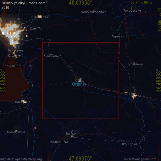
Analysis of Orikhiv night lights 2016
Square area 10x10 km:
 0.43%
0.43%90-99
0.14%80-89
0%70-79
0%60-69
0%50-59
1.42%40-49
1.14%30-39
0.71%20-29
0.14%10-19
0%0-9
96.02%Square area 50x50 km:
0.02%90-99
0.01%80-89
0%70-79
0%60-69
0%50-59
0.06%40-49
0.05%30-39
0.08%20-29
0.01%10-19
0.02%0-9
99.77%Clear (daylight) street map image can be seen on geolist.org.
Map coordinates:
48° 2' 22.5" North, 35° 4' 57.5" East
47° 34' 2.3" North, 35° 47' 8.7" East
47° 5' 26.7" North, 36° 29' 20" East
Some cities around Orikhiv sort by population:
• Zaporizhia
52.9 km =32.9 mi,  302°
302°
• Tokmak
35.1 km =21.8 mi,  189°
189°
• Polohy
36.3 km =22.6 mi,  104°
104°
• Hulyaypole
36.9 km =22.9 mi,  73°
73°
• Vasylivka
41.1 km =25.5 mi,  249°
249°
• Kushuhum
46.1 km =28.6 mi,  290°
290°
• Novomykolayivka
46.6 km =29 mi,  11°
11°
• Komyshuvakha
25.3 km =15.7 mi,  310°
310°
698428 (p: 17,287)
Sources (retrieved 2019-11-25):
» Earth at Night: Flat Maps 2012, 2016