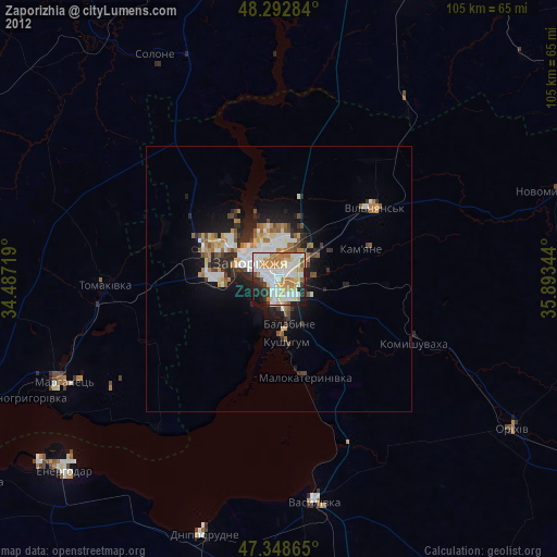
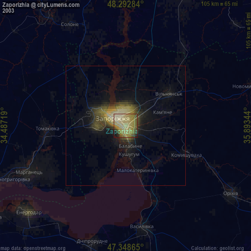
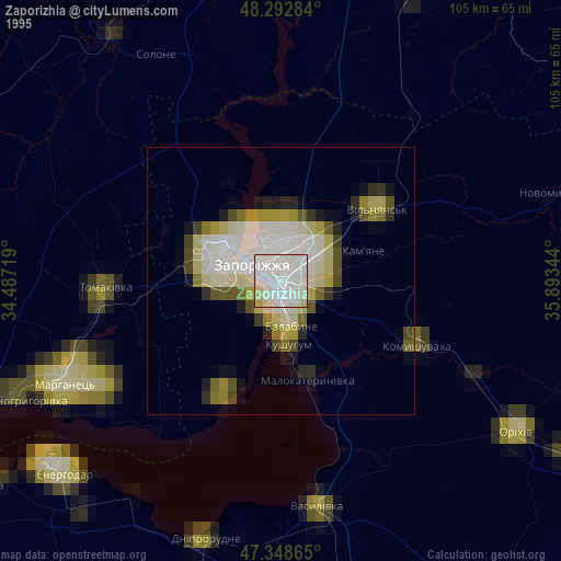
Zaporizhia night lights from space
Night Light of Zaporizhia from space (Ukraine) Src. Average luminocity for 10x10km area is 72.064% and for 50x50km: 8.4305%.

Analysis of Zaporizhia night lights 2016
Square area 10x10 km:
 19.79%
90-99
20.09%80-89
7.74%70-79
11.46%60-69
13.1%50-59
5.8%40-49
2.98%30-39
5.51%20-29
9.67%10-19
3.87%0-9
0%Square area 50x50 km:
1.59%90-99
1.87%80-89
0.69%70-79
0.95%60-69
1.07%50-59
1.04%40-49
0.79%30-39
1.19%20-29
2.8%10-19
4.73%0-9
83.29%Clear (daylight) street map image can be seen on geolist.org.
Map coordinates:
48° 17' 34.2" North, 34° 29' 13.9" East
47° 49' 22.4" North, 35° 11' 25.1" East
47° 20' 55.1" North, 35° 53' 36.4" East
Some cities around Zaporizhia sort by population:
• Marhanets’
47 km =29.2 mi,  243°
243°
• Dniprorudne
51.6 km =32.1 mi,  198°
198°
• Vasylivka
43.4 km =27 mi,  171°
171°
• Tomakivka
33.5 km =20.8 mi,  268°
268°
• Kushuhum
12.3 km =7.6 mi, 173°
• Solone
48.9 km =30.4 mi,  331°
331°
• Vil’ne
35 km =21.7 mi,  233°
233°
• Komyshuvakha
28 km =17.4 mi,  115°
115°
687700 (p: 796,217)
Sources (retrieved 2019-11-25):
» NASA, Earths city lights 1995
» NASA city lights 2003
» Earth at Night: Flat Maps 2012, 2016