Kobelyaky night lights from space
Night Light of Kobelyaky (Poltava) from space (Ukraine) Src. Average luminocity for 10x10km area is 0.0616% and for 50x50km: 0.1033%.
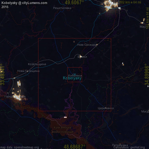
Analysis of Kobelyaky night lights 2016
Square area 10x10 km:
 0%
0%90-99
0%80-89
0%70-79
0%60-69
0%50-59
0%40-49
0%30-39
0%20-29
0%10-19
0%0-9
100%Square area 50x50 km:
0.01%90-99
0.01%80-89
0.01%70-79
0.01%60-69
0.02%50-59
0%40-49
0.02%30-39
0.02%20-29
0.07%10-19
0.03%0-9
99.79%Clear (daylight) street map image can be seen on geolist.org.
Map coordinates:
49° 36' 24.1" North, 33° 29' 36.3" East
49° 8' 56.1" North, 34° 11' 47.5" East
48° 41' 12.7" North, 34° 53' 58.8" East
Some cities around Kobelyaky sort by population:
• Poltava
55.4 km =34.4 mi,  26°
26°
• Kremenchuk
57.2 km =35.5 mi,  260°
260°
• Horishni Plavni
43.7 km =27.2 mi,  249°
249°
• Svitlovods’k
70.4 km =43.7 mi, 260°
• Reshetylivka
47.1 km =29.3 mi,  349°
349°
• Novi Sanzhary
23.2 km =14.4 mi,  20°
20°
• Tsarychanka
31.3 km =19.4 mi,  138°
138°
• Mahdalynivka
58.2 km =36.2 mi,  115°
115°
705544 (p: 11,692)
Sources (retrieved 2019-11-25):
» Earth at Night: Flat Maps 2012, 2016