Kremenchuk night lights from space
Night Light of Kremenchuk (Poltava) from space (Ukraine) Src. Average luminocity for 10x10km area is 40.3438% and for 50x50km: 5.0778%.
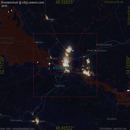
Analysis of Kremenchuk night lights 2016
Square area 10x10 km:
 8.18%
8.18%90-99
10.86%80-89
3.87%70-79
5.21%60-69
2.23%50-59
2.98%40-49
3.72%30-39
4.91%20-29
13.84%10-19
27.08%0-9
17.11%Square area 50x50 km:
0.81%90-99
0.99%80-89
0.45%70-79
0.44%60-69
0.49%50-59
0.42%40-49
0.68%30-39
0.67%20-29
1.52%10-19
4.61%0-9
88.91%Clear (daylight) street map image can be seen on geolist.org.
Map coordinates:
49° 31' 35.6" North, 32° 43' 2.2" East
49° 4' 4.9" North, 33° 25' 13.5" East
48° 36' 18.8" North, 34° 7' 24.7" East
Some cities around Kremenchuk sort by population:
• Oleksandriya
49.6 km =30.8 mi,  206°
206°
• Horishni Plavni
17 km =10.6 mi,  112°
112°
• Svitlovods’k
13.2 km =8.2 mi,  260°
260°
• Hlobyne
37.4 km =23.2 mi,  341°
341°
• Kobelyaky
57.2 km =35.5 mi,  80°
80°
• Chyhyryn
55.7 km =34.6 mi,  271°
271°
• Hradyz’k
27.8 km =17.3 mi,  311°
311°
• Oleksandriys’ke
60.4 km =37.5 mi, 211°
704147 (p: 227,494)
Sources (retrieved 2019-11-25):
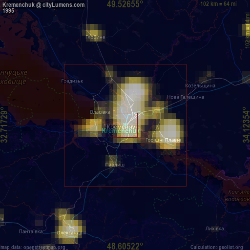
» NASA, Earths city lights 1995
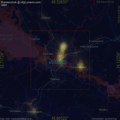
» NASA city lights 2003
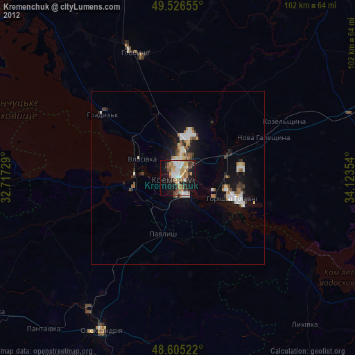
» Earth at Night: Flat Maps 2012, 2016