Svitlovods’k night lights from space
Night Light of Svitlovods’k (Kirovohrad) from space (Ukraine) Src. Average luminocity for 10x10km area is 2.2783% and for 50x50km: 3.5535%.
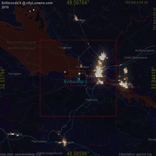
Analysis of Svitlovods’k night lights 2016
Square area 10x10 km:
 0.3%
0.3%90-99
0.89%80-89
0%70-79
0%60-69
0%50-59
0%40-49
1.19%30-39
0%20-29
0.6%10-19
1.79%0-9
95.24%Square area 50x50 km:
0.58%90-99
0.75%80-89
0.29%70-79
0.36%60-69
0.26%50-59
0.34%40-49
0.49%30-39
0.52%20-29
1.14%10-19
3.01%0-9
92.26%Clear (daylight) street map image can be seen on geolist.org.
Map coordinates:
49° 30' 27.5" North, 32° 32' 16.6" East
49° 2' 56.2" North, 33° 14' 27.8" East
48° 35' 9.5" North, 33° 56' 39.1" East
Some cities around Svitlovods’k sort by population:
• Kremenchuk
13.2 km =8.2 mi,  80°
80°
• Oleksandriya
43.2 km =26.8 mi,  192°
192°
• Horishni Plavni
29.1 km =18.1 mi,  98°
98°
• Znomenka
56.3 km =35 mi,  228°
228°
• Hlobyne
37.7 km =23.4 mi,  2°
2°
• Chyhyryn
42.8 km =26.6 mi,  275°
275°
• Hradyz’k
22 km =13.7 mi,  339°
339°
• Oleksandriys’ke
52.6 km =32.7 mi,  201°
201°
692087 (p: 47,946)
Sources (retrieved 2019-11-25):
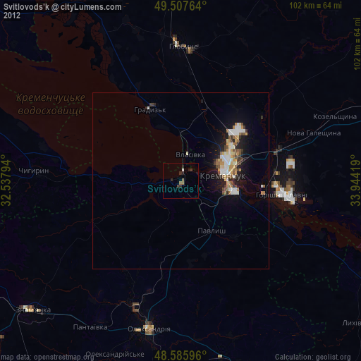
» Earth at Night: Flat Maps 2012, 2016