Tsarychanka night lights from space
Night Light of Tsarychanka (Dnipropetrovsk) from space (Ukraine) Src. Average luminocity for 10x10km area is 0.169% and for 50x50km: 0.0185%.
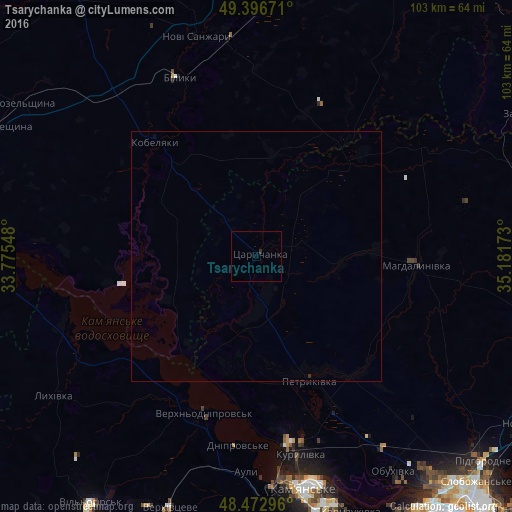
Analysis of Tsarychanka night lights 2016
Square area 10x10 km:
 0%
0%90-99
0%80-89
0%70-79
0%60-69
0%50-59
0%40-49
0%30-39
0%20-29
0.57%10-19
0%0-9
99.43%Square area 50x50 km:
0%90-99
0%80-89
0%70-79
0%60-69
0%50-59
0%40-49
0%30-39
0.02%20-29
0.02%10-19
0%0-9
99.95%Clear (daylight) street map image can be seen on geolist.org.
Map coordinates:
49° 23' 48.2" North, 33° 46' 31.7" East
48° 56' 13.1" North, 34° 28' 43" East
48° 28' 22.7" North, 35° 10' 54.2" East
Some cities around Tsarychanka sort by population:
• Kamianske
48.2 km =30 mi,  169°
169°
• Novomoskovs’k
65.3 km =40.6 mi,  120°
120°
• Horishni Plavni
62.1 km =38.6 mi,  277°
277°
• Pidhorodne
61.1 km =38 mi,  131°
131°
• Kobelyaky
31.3 km =19.4 mi,  318°
318°
• Novi Sanzhary
46.9 km =29.1 mi,  344°
344°
• Mahdalynivka
31.9 km =19.8 mi,  93°
93°
• Hubynykha
58.6 km =36.4 mi,  103°
103°
691155 (p: 7,638)
Sources (retrieved 2019-11-25):
» Earth at Night: Flat Maps 2012, 2016