Üsküdar night lights from space
Night Light of Üsküdar (Istanbul) from space (Turkey) Src. Average luminocity for 10x10km area is 91.9269% and for 50x50km: 47.7974%.
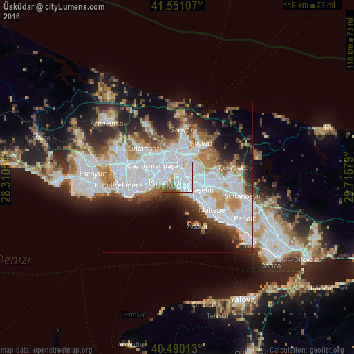
Analysis of Üsküdar night lights 2016
Square area 10x10 km:
 55.27%
90-99
25.34%80-89
3.74%70-79
1.19%60-69
4.93%50-59
3.06%40-49
4.93%30-39
1.53%20-29
0%10-19
0%0-9
0%Square area 50x50 km:
18.71%90-99
10.26%80-89
2.87%70-79
4.5%60-69
5.38%50-59
4.71%40-49
4.1%30-39
4.56%20-29
8.27%10-19
9.39%0-9
27.26%Clear (daylight) street map image can be seen on geolist.org.
Map coordinates:
41° 33' 3.9" North, 28° 18' 37.9" East
41° 1' 21.9" North, 29° 0' 49.2" East
40° 29' 24.5" North, 29° 43' 0.4" East
Some cities around Üsküdar sort by population:
• Istanbul
5.5 km =3.4 mi,  259°
259°
• Umraniye
9.3 km =5.8 mi,  94°
94°
• Ataşehir
9.7 km =6 mi,  116°
116°
• Şişli
4.7 km =2.9 mi,  332°
332°
• Zeytinburnu
9.7 km =6 mi,  251°
251°
• Eminönü
3.3 km =2.1 mi, 260°
• Merter Keresteciler
10.8 km =6.7 mi, 264°
• güngören merter
10.7 km =6.6 mi, 260°
738329 (p: 582,666)
Sources (retrieved 2019-11-25):
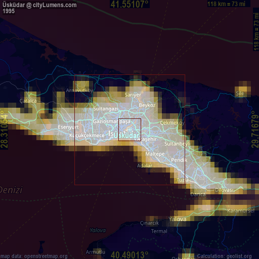
» NASA, Earths city lights 1995
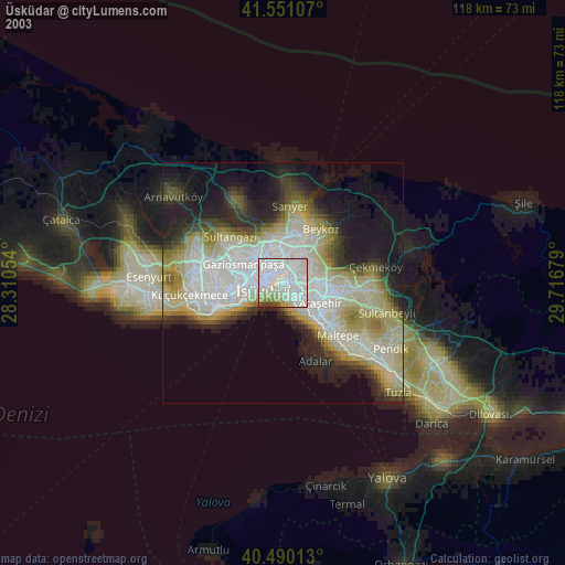
» NASA city lights 2003
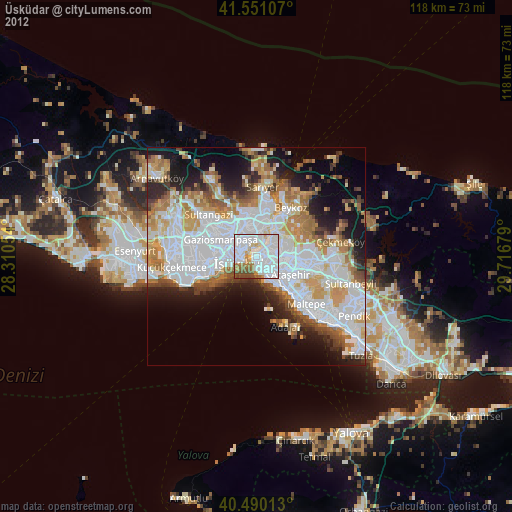
» Earth at Night: Flat Maps 2012, 2016