Zeytinburnu night lights from space
Night Light of Zeytinburnu (Istanbul) from space (Turkey) Src. Average luminocity for 10x10km area is 81.0816% and for 50x50km: 45.2067%.
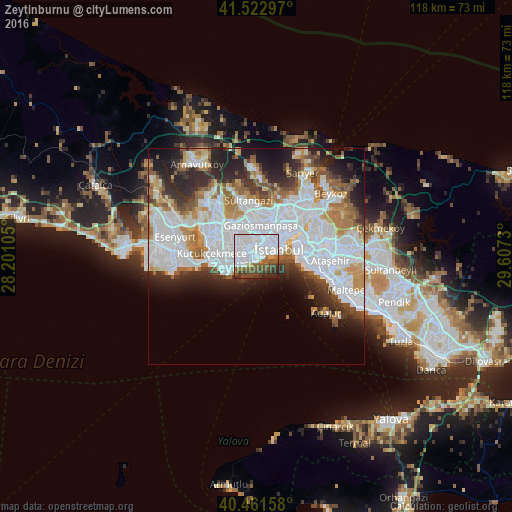
Analysis of Zeytinburnu night lights 2016
Square area 10x10 km:
 54.42%
90-99
8.16%80-89
2.89%70-79
0.85%60-69
4.59%50-59
10.37%40-49
9.18%30-39
6.63%20-29
2.89%10-19
0%0-9
0%Square area 50x50 km:
18.44%90-99
9.73%80-89
2.75%70-79
4%60-69
5.04%50-59
4.45%40-49
3.29%30-39
4.19%20-29
7.63%10-19
8.24%0-9
32.24%Clear (daylight) street map image can be seen on geolist.org.
Map coordinates:
41° 31' 22.7" North, 28° 12' 3.8" East
40° 59' 39.9" North, 28° 54' 15" East
40° 27' 41.7" North, 29° 36' 26.3" East
Some cities around Zeytinburnu sort by population:
• Istanbul
4.4 km =2.7 mi,  60°
60°
• Bağcılar
6.4 km =4 mi,  321°
321°
• Üsküdar
9.7 km =6 mi,  71°
71°
• Bahçelievler
3.8 km =2.4 mi,  283°
283°
• Esenler
5.9 km =3.7 mi,  336°
336°
• Eminönü
6.4 km =4 mi, 66°
• Merter Keresteciler
2.6 km =1.6 mi, 323°
• güngören merter
2 km =1.2 mi, 316°
737071 (p: 288,743)
Sources (retrieved 2019-11-25):
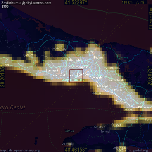
» NASA, Earths city lights 1995
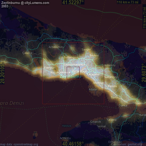
» NASA city lights 2003
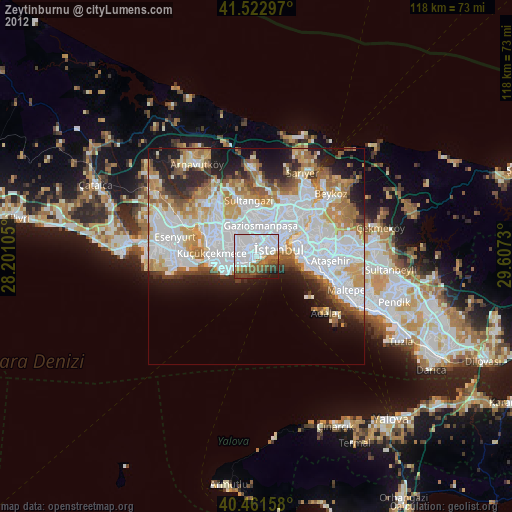
» Earth at Night: Flat Maps 2012, 2016