Ataşehir night lights from space
Night Light of Ataşehir (Istanbul) from space (Turkey) Src. Average luminocity for 10x10km area is 95.3452% and for 50x50km: 46.2212%.
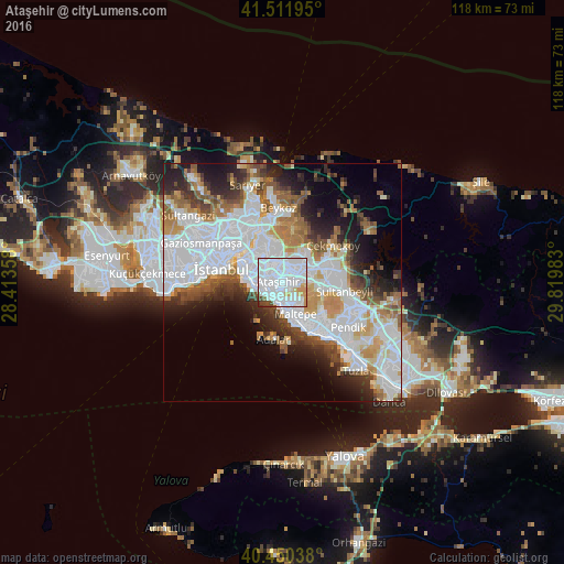
Analysis of Ataşehir night lights 2016
Square area 10x10 km:
 64.8%
64.8%90-99
22.28%80-89
3.4%70-79
4.42%60-69
0.34%50-59
1.53%40-49
2.89%30-39
0.17%20-29
0.17%10-19
0%0-9
0%Square area 50x50 km:
18.48%90-99
9.93%80-89
3.12%70-79
4.44%60-69
4.93%50-59
4.54%40-49
3.72%30-39
4.23%20-29
6.37%10-19
8.61%0-9
31.63%Clear (daylight) street map image can be seen on geolist.org.
Map coordinates:
41° 30' 43" North, 28° 24' 48.9" East
40° 58' 59.9" North, 29° 7' 0.1" East
40° 27' 1.4" North, 29° 49' 11.4" East
Some cities around Ataşehir sort by population:
• Üsküdar
9.7 km =6 mi,  296°
296°
• Umraniye
3.7 km =2.3 mi,  10°
10°
• Maltepe
6.2 km =3.9 mi,  148°
148°
• Şişli
13.8 km =8.6 mi,  308°
308°
• Sultanbeyli
13.2 km =8.2 mi,  100°
100°
• Sancaktepe
9.9 km =6.2 mi,  77°
77°
• Eminönü
12.5 km =7.8 mi,  287°
287°
• Adalar
12.9 km =8 mi,  173°
173°
6947637 (p: 361,615)
Sources (retrieved 2019-11-25):
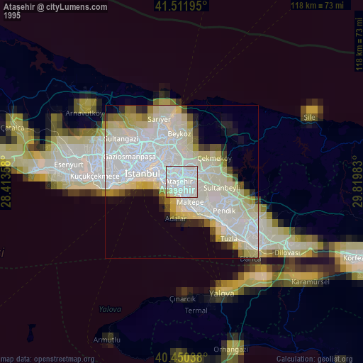
» NASA, Earths city lights 1995
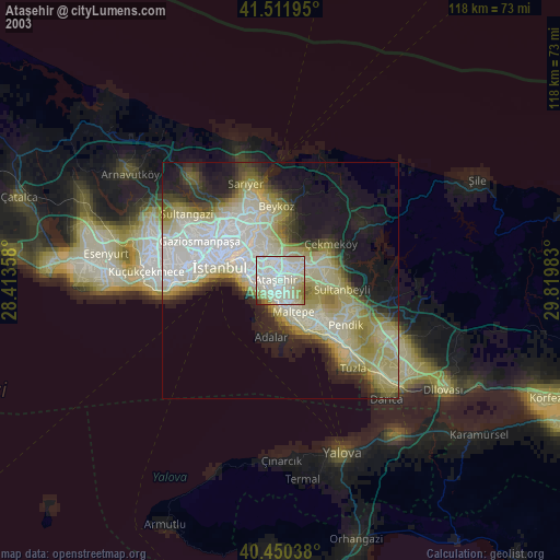
» NASA city lights 2003
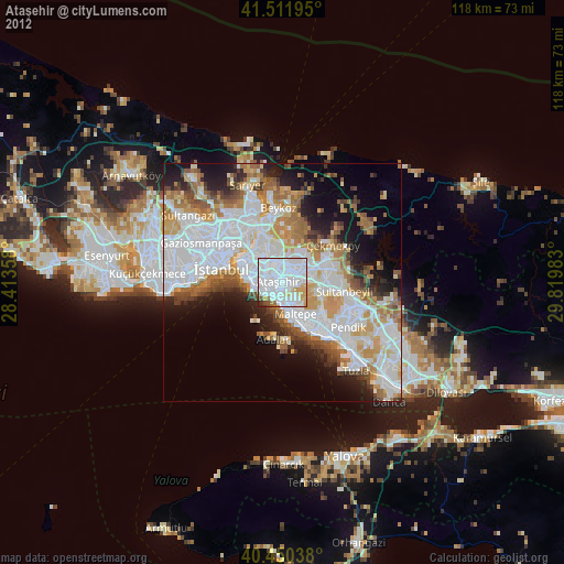
» Earth at Night: Flat Maps 2012, 2016