Şişli night lights from space
Night Light of Şişli (Istanbul) from space (Turkey) Src. Average luminocity for 10x10km area is 98.4253% and for 50x50km: 48.8126%.
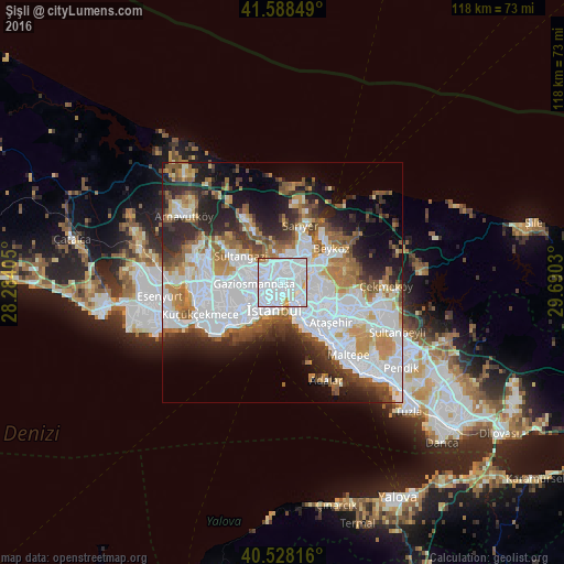
Analysis of Şişli night lights 2016
Square area 10x10 km:
 73.21%
90-99
20.78%80-89
3.57%70-79
1.14%60-69
1.3%50-59
0%40-49
0%30-39
0%20-29
0%10-19
0%0-9
0%Square area 50x50 km:
18.72%90-99
10.19%80-89
3%70-79
4.85%60-69
5.64%50-59
5.17%40-49
4.13%30-39
4.83%20-29
8.69%10-19
9.67%0-9
25.12%Clear (daylight) street map image can be seen on geolist.org.
Map coordinates:
41° 35' 18.6" North, 28° 17' 2.6" East
41° 3' 37.7" North, 28° 59' 13.8" East
40° 31' 41.4" North, 29° 41' 25.1" East
Some cities around Şişli sort by population:
• Istanbul
6.1 km =3.8 mi,  211°
211°
• Bağcılar
11.2 km =7 mi,  257°
257°
• Üsküdar
4.7 km =2.9 mi,  152°
152°
• Esenler
9.5 km =5.9 mi, 258°
• Zeytinburnu
10.1 km =6.3 mi,  223°
223°
• Eminönü
4.9 km =3 mi,  192°
192°
• güngören merter
10.2 km =6.3 mi,  234°
234°
• Merter Keresteciler
10 km =6.2 mi,  238°
238°
739549 (p: 314,684)
Sources (retrieved 2019-11-25):
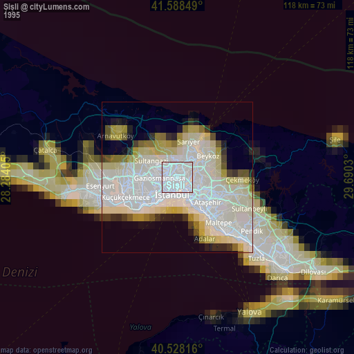
» NASA, Earths city lights 1995
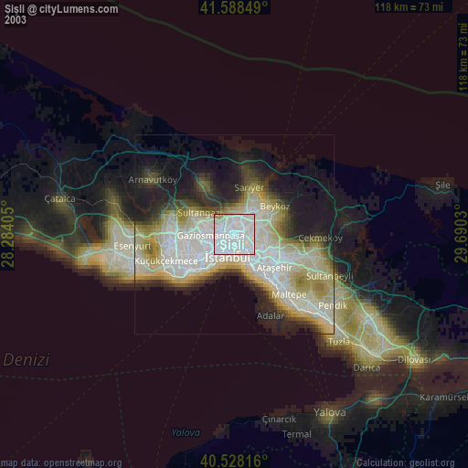
» NASA city lights 2003
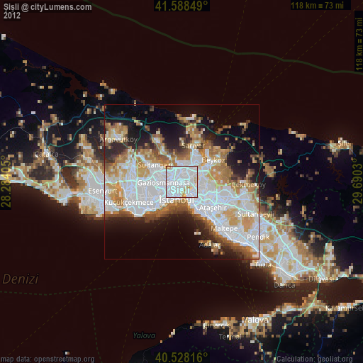
» Earth at Night: Flat Maps 2012, 2016