Gölcük night lights from space
Night Light of Gölcük (Kocaeli) from space (Turkey) Src. Average luminocity for 10x10km area is 60.1315% and for 50x50km: 18.6912%.
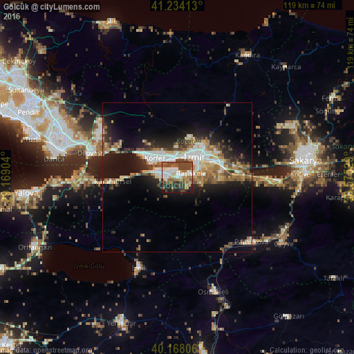
Analysis of Gölcük night lights 2016
Square area 10x10 km:
 10.55%
90-99
12.34%80-89
7.14%70-79
5.36%60-69
10.55%50-59
9.74%40-49
22.89%30-39
7.63%20-29
9.42%10-19
4.38%0-9
0%Square area 50x50 km:
2.88%90-99
3.48%80-89
2.06%70-79
2.06%60-69
2.63%50-59
3.01%40-49
3.24%30-39
2.59%20-29
4.93%10-19
10.89%0-9
62.23%Clear (daylight) street map image can be seen on geolist.org.
Map coordinates:
41° 14' 2.9" North, 29° 10' 8.5" East
40° 42' 11.6" North, 29° 52' 19.8" East
40° 10' 5" North, 30° 34' 31" East
Some cities around Gölcük sort by population:
• İzmit
8.4 km =5.2 mi,  35°
35°
• Derince
7.7 km =4.8 mi,  320°
320°
• Körfez
10.3 km =6.4 mi,  313°
313°
• Köseköy
12 km =7.5 mi,  69°
69°
• İhsaniye
3.4 km =2.1 mi,  246°
246°
• Kullar
10.2 km =6.3 mi,  76°
76°
• Bahçecik
5.3 km =3.3 mi,  137°
137°
• Yuvacık
8.2 km =5.1 mi,  101°
101°
746666 (p: 56,189)
Sources (retrieved 2019-11-25):
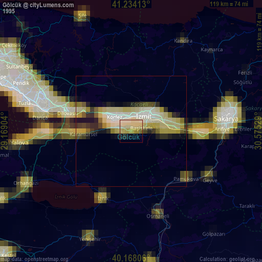
» NASA, Earths city lights 1995
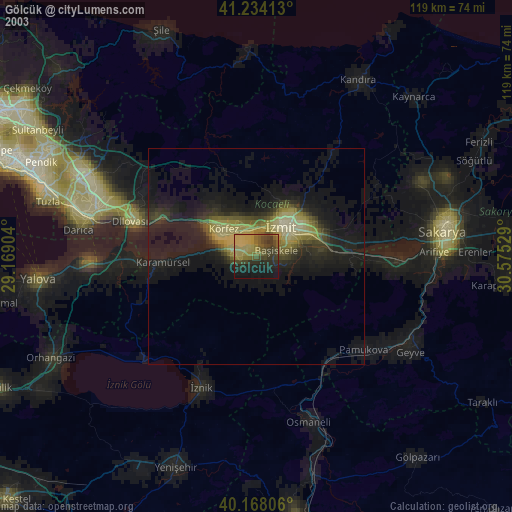
» NASA city lights 2003
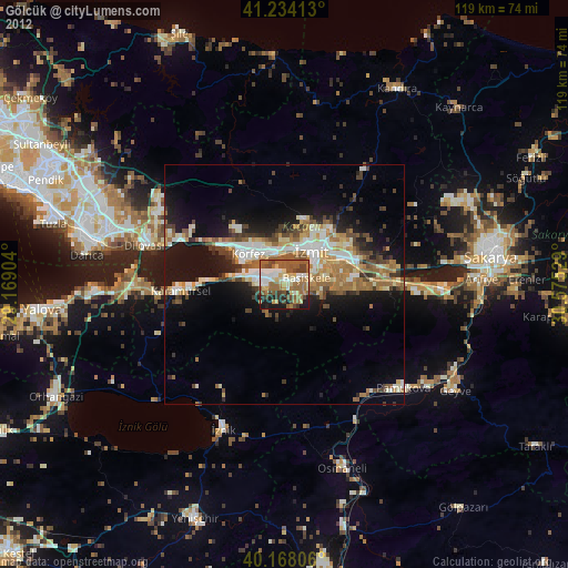
» Earth at Night: Flat Maps 2012, 2016