Derince night lights from space
Night Light of Derince (Kocaeli) from space (Turkey) Src. Average luminocity for 10x10km area is 75.9042% and for 50x50km: 19.8044%.
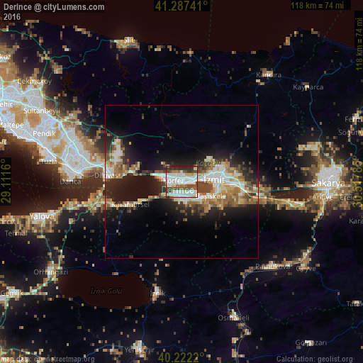
Analysis of Derince night lights 2016
Square area 10x10 km:
 27.6%
27.6%90-99
25.65%80-89
4.55%70-79
3.57%60-69
5.03%50-59
7.47%40-49
11.2%30-39
7.63%20-29
7.31%10-19
0%0-9
0%Square area 50x50 km:
3.23%90-99
3.94%80-89
2.13%70-79
2.2%60-69
2.76%50-59
2.91%40-49
3.18%30-39
2.58%20-29
5.84%10-19
11.27%0-9
59.97%Clear (daylight) street map image can be seen on geolist.org.
Map coordinates:
41° 17' 14.7" North, 29° 6' 41.8" East
40° 45' 25" North, 29° 48' 53" East
40° 13' 19.9" North, 30° 31' 4.3" East
Some cities around Derince sort by population:
• İzmit
9.7 km =6 mi,  84°
84°
• Körfez
2.9 km =1.8 mi,  292°
292°
• Gölcük
7.7 km =4.8 mi,  140°
140°
• Köseköy
16.2 km =10.1 mi,  96°
96°
• İhsaniye
7.5 km =4.7 mi,  167°
167°
• Kullar
15.2 km =9.4 mi, 103°
• Bahçecik
13 km =8.1 mi, 139°
• Yuvacık
15 km =9.3 mi,  120°
120°
748208 (p: 125,485)
Sources (retrieved 2019-11-25):
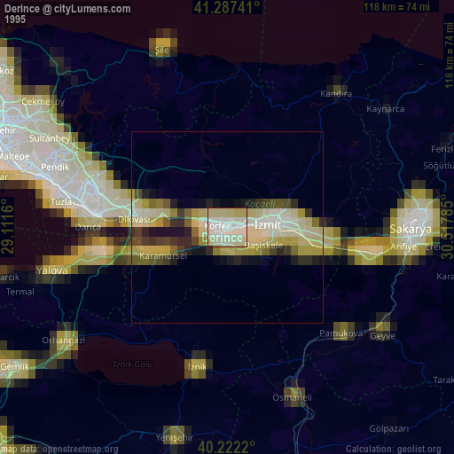
» NASA, Earths city lights 1995
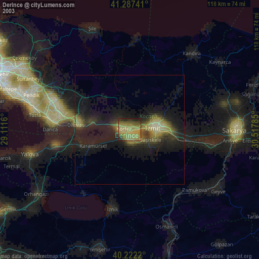
» NASA city lights 2003
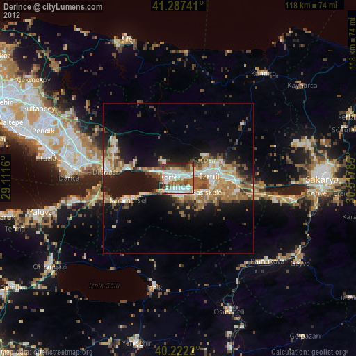
» Earth at Night: Flat Maps 2012, 2016