Gaziantep night lights from space
Night Light of Gaziantep from space (Turkey) Src. Average luminocity for 10x10km area is 96.3044% and for 50x50km: 19.5223%.
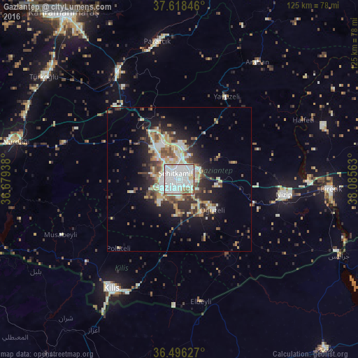

Analysis of Gaziantep night lights 2016
Square area 10x10 km:
 60.71%
90-99
28.23%80-89
4.08%70-79
2.38%60-69
2.55%50-59
1.36%40-49
0.68%30-39
0%20-29
0%10-19
0%0-9
0%Square area 50x50 km:
3.7%90-99
4.52%80-89
2.07%70-79
2.07%60-69
1.92%50-59
2.05%40-49
3.02%30-39
2.93%20-29
5.02%10-19
8.45%0-9
64.26%Clear (daylight) street map image can be seen on geolist.org.
Map coordinates:
37° 37' 6.5" North, 36° 40' 45.8" East
37° 3' 34" North, 37° 22' 57" East
36° 29' 46.6" North, 38° 5' 8.3" East
Some cities around Gaziantep sort by population:
• Nizip
37 km =23 mi,  98°
98°
• Kilis
45 km =28 mi,  211°
211°
• Birecik
53 km =32.9 mi,  94°
94°
• Pazarcık
48.1 km =29.9 mi,  351°
351°
• Nurdağı
58.6 km =36.4 mi,  281°
281°
• Oğuzeli
15.6 km =9.7 mi,  131°
131°
• Araban
49 km =30.4 mi,  33°
33°
• Yavuzeli
33.1 km =20.6 mi, 29°
314830 (p: 1,065,975)
Sources (retrieved 2019-11-25):
» NASA, Earths city lights 1995
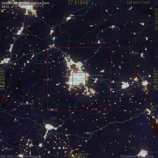
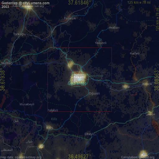
» NASA city lights 2003
» Earth at Night: Flat Maps 2012, 2016