Kasserine night lights from space
Night Light of Kasserine (Al Qaşrayn) from space (Tunisia) Src. Average luminocity for 10x10km area is 26.028% and for 50x50km: 1.7263%.
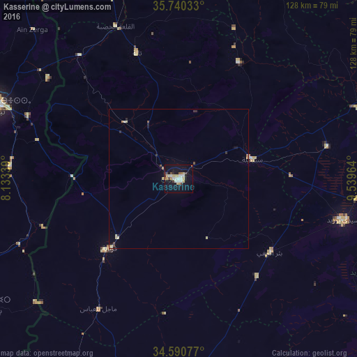
Analysis of Kasserine night lights 2016
Square area 10x10 km:
 3.85%
3.85%90-99
5.42%80-89
5.07%70-79
3.15%60-69
1.4%50-59
1.4%40-49
2.62%30-39
1.57%20-29
1.05%10-19
32.17%0-9
42.31%Square area 50x50 km:
0.17%90-99
0.25%80-89
0.43%70-79
0.16%60-69
0.18%50-59
0.13%40-49
0.18%30-39
0.16%20-29
0.2%10-19
1.39%0-9
96.77%Clear (daylight) street map image can be seen on geolist.org.
Map coordinates:
35° 44' 25.2" North, 8° 8' 0.2" East
35° 10' 3.3" North, 8° 50' 11.4" East
34° 35' 26.8" North, 9° 32' 22.7" East
Some cities around Kasserine sort by population:
• Tébessa, DZ
69.8 km =43.4 mi,  292°
292°
• Gafsa
82.7 km =51.4 mi,  183°
183°
• Sidi Bouzid
60.7 km =37.7 mi,  103°
103°
• Thala
47.5 km =29.5 mi,  341°
341°
• Sbiba
47 km =29.2 mi,  27°
27°
• Jilma
54.6 km =33.9 mi,  77°
77°
• El Ksour
81.1 km =50.4 mi,  3°
3°
• Bir el Hafey
41.7 km =25.9 mi,  128°
128°
2473457 (p: 81,987)
Sources (retrieved 2019-11-25):
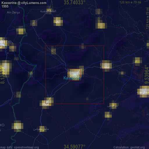
» NASA, Earths city lights 1995
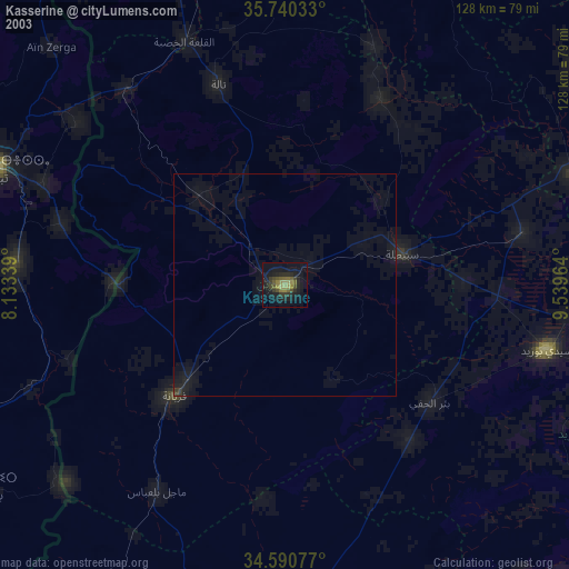
» NASA city lights 2003
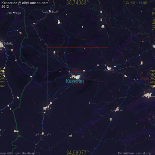
» Earth at Night: Flat Maps 2012, 2016