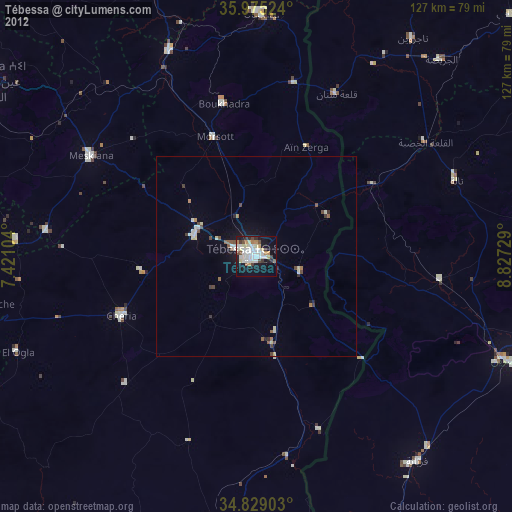
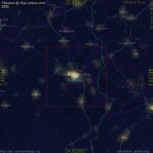
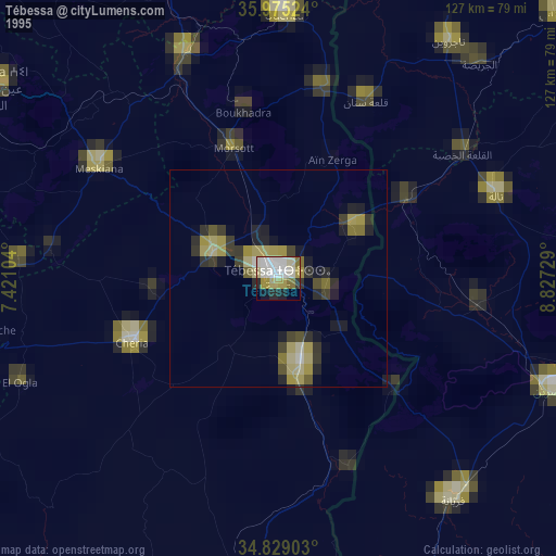
Tébessa night lights from space
Night Light of Tébessa from space (Algeria) Src. Average luminocity for 10x10km area is 51.3956% and for 50x50km: 4.0484%.
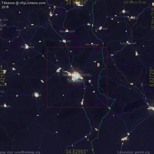
Analysis of Tébessa night lights 2016
Square area 10x10 km:
 13.37%
90-99
10.99%80-89
8.24%70-79
9.89%60-69
1.47%50-59
3.11%40-49
2.75%30-39
6.04%20-29
12.64%10-19
27.11%0-9
4.4%Square area 50x50 km:
0.64%90-99
0.59%80-89
0.74%70-79
0.79%60-69
0.16%50-59
0.22%40-49
0.2%30-39
0.61%20-29
0.86%10-19
2.85%0-9
92.35%Clear (daylight) street map image can be seen on geolist.org.
Map coordinates:
35° 58' 30.9" North, 7° 25' 15.7" East
35° 24' 15" North, 8° 7' 27" East
34° 49' 44.5" North, 8° 49' 38.2" East
Some cities around Tébessa sort by population:
• Kasserine, TN
69.8 km =43.4 mi,  112°
112°
• Cheria
36.8 km =22.9 mi,  246°
246°
• Bir el Ater
73.5 km =45.7 mi,  184°
184°
• El Aouinet
55.7 km =34.6 mi,  337°
337°
• Meskiana
48.5 km =30.1 mi,  301°
301°
• Hammamet
16.4 km =10.2 mi,  287°
287°
• Tajerouine, TN
66.6 km =41.4 mi,  35°
35°
• Thala, TN
52.9 km =32.9 mi,  69°
69°
2477461 (p: 634,332)
Sources (retrieved 2019-11-25):
» NASA, Earths city lights 1995
» NASA city lights 2003
» Earth at Night: Flat Maps 2012, 2016