Saýat night lights from space
Night Light of Saýat (Lebap) from space (Turkmenistan) Src. Average luminocity for 10x10km area is 23.6102% and for 50x50km: 4.9513%.
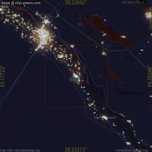
Analysis of Saýat night lights 2016
Square area 10x10 km:
 1.41%
1.41%90-99
3.17%80-89
5.11%70-79
3%60-69
3.17%50-59
1.59%40-49
4.59%30-39
2.47%20-29
1.23%10-19
33.33%0-9
40.92%Square area 50x50 km:
0.13%90-99
0.41%80-89
0.81%70-79
0.65%60-69
0.62%50-59
0.61%40-49
1%30-39
1.14%20-29
1.2%10-19
4.78%0-9
88.64%Clear (daylight) street map image can be seen on geolist.org.
Map coordinates:
39° 19' 47.7" North, 63° 10' 38" East
38° 47' 2.1" North, 63° 52' 49.3" East
38° 14' 1.4" North, 64° 35' 0.5" East
Some cities around Saýat sort by population:
• Bukhara, UZ
119.8 km =74.4 mi,  23°
23°
• Türkmenabat
41.4 km =25.7 mi,  320°
320°
• Kogon, UZ
119.3 km =74.1 mi,  28°
28°
• Karakul’, UZ
83.4 km =51.8 mi,  357°
357°
• Seydi
113.9 km =70.8 mi,  312°
312°
• Farap
48.8 km =30.3 mi,  331°
331°
• Olot, UZ
70.5 km =43.8 mi,  354°
354°
• Qorovulbozor, UZ
112 km =69.6 mi,  44°
44°
1218436 (p: 17,762)
Sources (retrieved 2019-11-25):
» Earth at Night: Flat Maps 2012, 2016