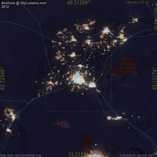
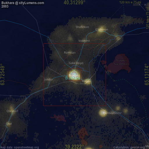
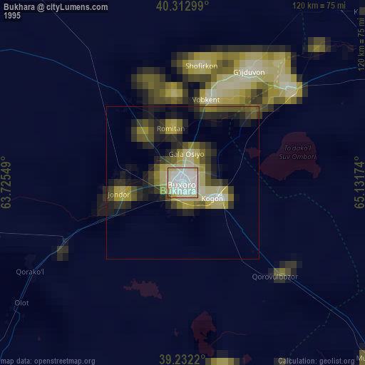
Bukhara night lights from space
Night Light of Bukhara from space (Uzbekistan) Src. Average luminocity for 10x10km area is 61.2463% and for 50x50km: 6.4986%.
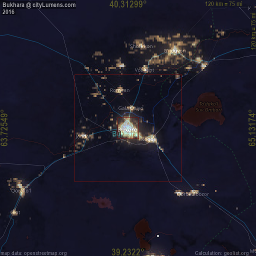
Analysis of Bukhara night lights 2016
Square area 10x10 km:
 8.7%
8.7%90-99
14.94%80-89
20.53%70-79
6.57%60-69
4.27%50-59
4.6%40-49
7.55%30-39
8.05%20-29
13.96%10-19
10.84%0-9
0%Square area 50x50 km:
0.48%90-99
0.76%80-89
1.35%70-79
0.48%60-69
0.54%50-59
0.78%40-49
1.18%30-39
1.77%20-29
1.95%10-19
4.98%0-9
85.72%Clear (daylight) street map image can be seen on geolist.org.
Map coordinates:
40° 18' 46.8" North, 63° 43' 31.8" East
39° 46' 29" North, 64° 25' 43" East
39° 13' 55.9" North, 65° 7' 54.3" East
Some cities around Bukhara sort by population:
• Kogon
12 km =7.5 mi,  118°
118°
• Ghijduwon
42.2 km =26.2 mi,  30°
30°
• Shofirkon
38.9 km =24.2 mi,  9°
9°
• Wobkent
29.4 km =18.3 mi, 14°
• Galaosiyo
9.4 km =5.8 mi, 10°
• Qiziltepa
46 km =28.6 mi,  51°
51°
• Romiton
17.7 km =11 mi,  346°
346°
• Qorovulbozor
43.7 km =27.2 mi,  134°
134°
1217662 (p: 247,644)
Sources (retrieved 2019-11-25):
» NASA, Earths city lights 1995
» NASA city lights 2003
» Earth at Night: Flat Maps 2012, 2016