Mary night lights from space
Night Light of Mary from space (Turkmenistan) Src. Average luminocity for 10x10km area is 84.6037% and for 50x50km: 31.2035%.
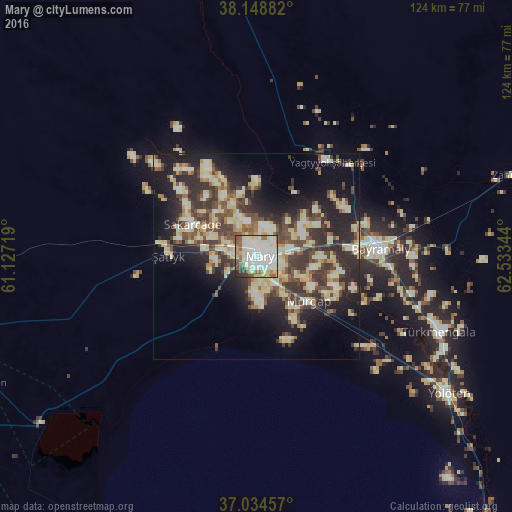
Analysis of Mary night lights 2016
Square area 10x10 km:
 32.65%
90-99
28.23%80-89
12.93%70-79
3.23%60-69
6.12%50-59
7.48%40-49
3.23%30-39
4.59%20-29
1.53%10-19
0%0-9
0%Square area 50x50 km:
2.78%90-99
6.72%80-89
7.8%70-79
2.19%60-69
2.57%50-59
3.67%40-49
6.08%30-39
7.1%20-29
9.5%10-19
13.89%0-9
37.7%Clear (daylight) street map image can be seen on geolist.org.
Map coordinates:
38° 8' 55.8" North, 61° 7' 37.9" East
37° 35' 37.6" North, 61° 49' 49.1" East
37° 2' 4.5" North, 62° 32' 0.4" East
Some cities around Mary sort by population:
• Türkmenabat
224.3 km =139.4 mi,  42°
42°
• Bayramaly
29.8 km =18.5 mi,  84°
84°
• Tejen
119.2 km =74.1 mi,  258°
258°
• Sarakhs, IR
131 km =81.4 mi,  207°
207°
• Yolöten
57.1 km =35.5 mi,  125°
125°
• Kaka
197.4 km =122.7 mi, 262°
• Saýat
222.7 km =138.4 mi,  53°
53°
• Murgab
16.5 km =10.3 mi, 130°
1218667 (p: 114,680)
Sources (retrieved 2019-11-25):
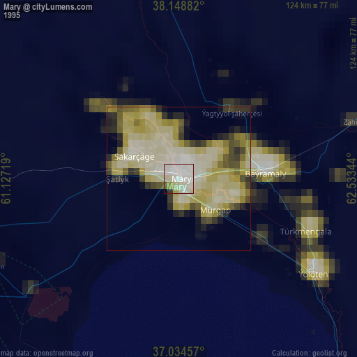
» NASA, Earths city lights 1995
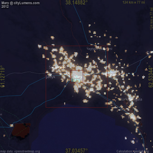
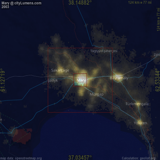
» NASA city lights 2003
» Earth at Night: Flat Maps 2012, 2016