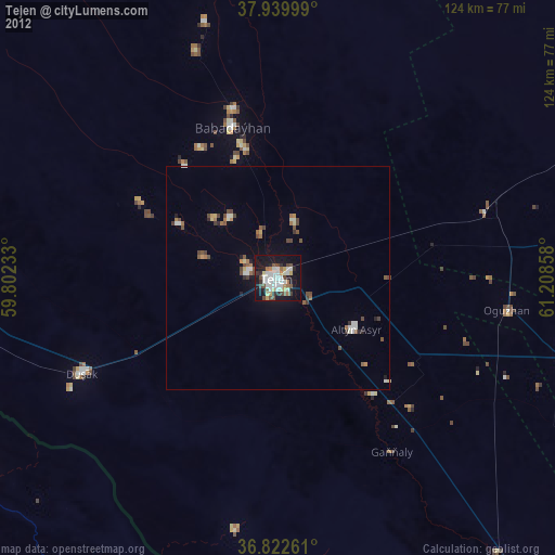
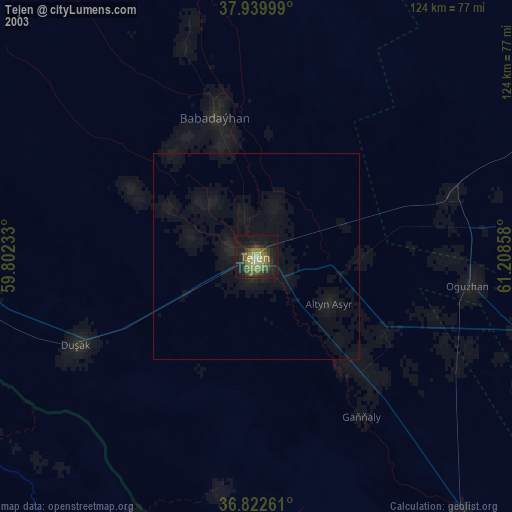
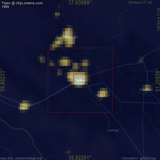
Tejen night lights from space
Night Light of Tejen (Ahal) from space (Turkmenistan) Src. Average luminocity for 10x10km area is 49.5179% and for 50x50km: 5.2987%.
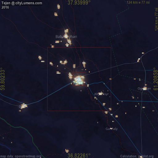
Analysis of Tejen night lights 2016
Square area 10x10 km:
 7.14%
7.14%90-99
13.15%80-89
9.9%70-79
2.76%60-69
7.47%50-59
2.27%40-49
6.66%30-39
6.98%20-29
17.86%10-19
25%0-9
0.81%Square area 50x50 km:
0.33%90-99
0.91%80-89
1.16%70-79
0.33%60-69
0.63%50-59
0.46%40-49
0.89%30-39
0.66%20-29
1.12%10-19
3.44%0-9
90.07%Clear (daylight) street map image can be seen on geolist.org.
Map coordinates:
37° 56' 24" North, 59° 48' 8.4" East
37° 23' 0.2" North, 60° 30' 19.6" East
36° 49' 21.4" North, 61° 12' 30.9" East
Some cities around Tejen sort by population:
• Mashhad, IR
145.1 km =90.2 mi,  215°
215°
• Mary
119.2 km =74.1 mi,  78°
78°
• Bayramaly
148.9 km =92.5 mi, 79°
• Chenārān, IR
147.8 km =91.8 mi,  236°
236°
• Sarakhs, IR
109.8 km =68.2 mi,  148°
148°
• Yolöten
164.2 km =102 mi,  93°
93°
• Kaka
78.8 km =49 mi,  267°
267°
• Murgab
130 km =80.8 mi, 84°
1218239 (p: 67,294)
Sources (retrieved 2019-11-25):
» NASA, Earths city lights 1995
» NASA city lights 2003
» Earth at Night: Flat Maps 2012, 2016