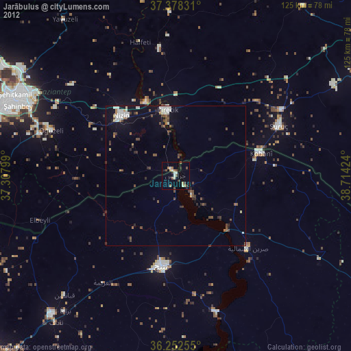
Jarābulus night lights from space
Night Light of Jarābulus (Aleppo) from space (Syria) Src. Average luminocity for 10x10km area is 8.6282% and for 50x50km: 4.8335%.
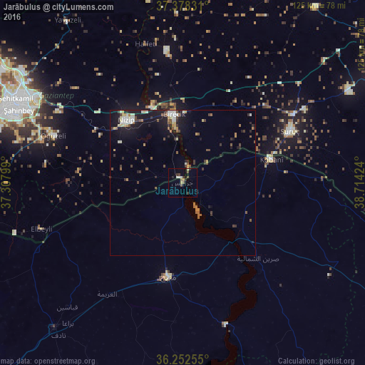
Analysis of Jarābulus night lights 2016
Square area 10x10 km:
 0.32%
0.32%90-99
2.11%80-89
0.16%70-79
0.65%60-69
0.65%50-59
1.3%40-49
2.6%30-39
1.95%20-29
1.95%10-19
0%0-9
88.31%Square area 50x50 km:
0.4%90-99
0.89%80-89
0.39%70-79
0.5%60-69
0.67%50-59
0.54%40-49
0.89%30-39
0.81%20-29
0.94%10-19
4.21%0-9
89.76%Clear (daylight) street map image can be seen on geolist.org.
Map coordinates:
37° 22' 41.9" North, 37° 18' 28.8" East
36° 49' 3" North, 38° 0' 40" East
36° 15' 9.2" North, 38° 42' 51.3" East
Some cities around Jarābulus sort by population:
• Gaziantep, TR
62 km =38.5 mi,  295°
295°
• Al Bāb
66.5 km =41.3 mi,  221°
221°
• Manbij
32.6 km =20.3 mi,  188°
188°
• Nizip, TR
28.8 km =17.9 mi,  317°
317°
• ‘Ayn al ‘Arab
31.5 km =19.6 mi,  74°
74°
• Suruç, TR
40.8 km =25.4 mi,  64°
64°
• Birecik, TR
23.3 km =14.5 mi,  352°
352°
• Oğuzeli, TR
47.2 km =29.3 mi,  290°
290°
169179 (p: 24,997)
Sources (retrieved 2019-11-25):
» Earth at Night: Flat Maps 2012, 2016