Al Bāb night lights from space
Night Light of Al Bāb (Aleppo) from space (Syria) Src. Average luminocity for 10x10km area is 0.3549% and for 50x50km: 0.1267%.
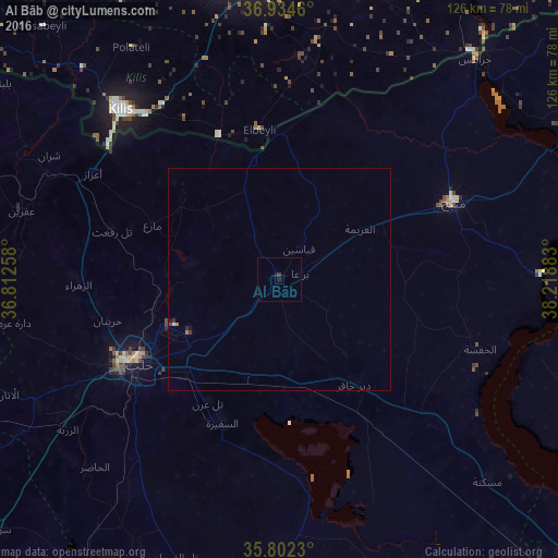

Analysis of Al Bāb night lights 2016
Square area 10x10 km:
 0%
0%90-99
0%80-89
0%70-79
0%60-69
0%50-59
0%40-49
0%30-39
0.7%20-29
0%10-19
0.17%0-9
99.13%Square area 50x50 km:
0%90-99
0.03%80-89
0%70-79
0%60-69
0.05%50-59
0.01%40-49
0.01%30-39
0.06%20-29
0.07%10-19
0.05%0-9
99.73%Clear (daylight) street map image can be seen on geolist.org.
Map coordinates:
36° 56' 4.6" North, 36° 48' 45.3" East
36° 22' 13.8" North, 37° 30' 56.5" East
35° 48' 8.3" North, 38° 13' 7.8" East
Some cities around Al Bāb sort by population:
• Aleppo
36.9 km =22.9 mi,  239°
239°
• Manbij
43 km =26.7 mi,  65°
65°
• I‘zāz
48.4 km =30.1 mi,  299°
299°
• As Safīrah
35.1 km =21.8 mi,  201°
201°
• Tādif
2.8 km =1.7 mi,  151°
151°
• Dayr Ḩāfir
29.3 km =18.2 mi,  144°
144°
• Tall Rif‘at
39.3 km =24.4 mi,  286°
286°
• Nubl
46.8 km =29.1 mi,  271°
271°
174018 (p: 130,745)
Sources (retrieved 2019-11-25):
» NASA, Earths city lights 1995
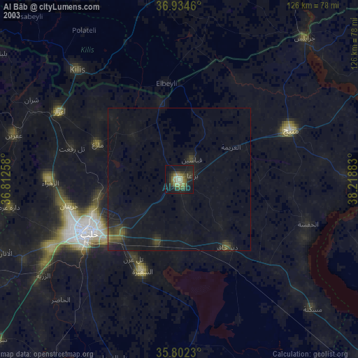
» NASA city lights 2003
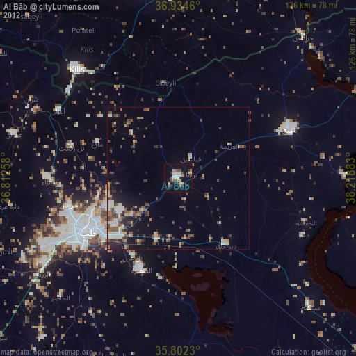
» Earth at Night: Flat Maps 2012, 2016