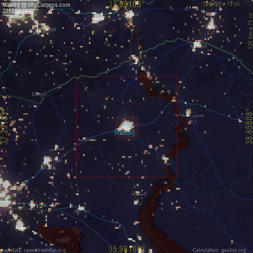
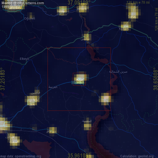
Manbij night lights from space
Night Light of Manbij (Aleppo) from space (Syria) Src. Average luminocity for 10x10km area is 11.1026% and for 50x50km: 0.8139%.
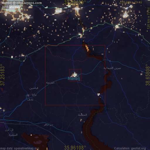

Analysis of Manbij night lights 2016
Square area 10x10 km:
 0%
0%90-99
1.47%80-89
3.48%70-79
0.92%60-69
1.47%50-59
0.92%40-49
3.66%30-39
1.28%20-29
1.47%10-19
0%0-9
85.35%Square area 50x50 km:
0%90-99
0.12%80-89
0.15%70-79
0.08%60-69
0.28%50-59
0.06%40-49
0.19%30-39
0.16%20-29
0.09%10-19
0.01%0-9
98.86%Clear (daylight) street map image can be seen on geolist.org.
Map coordinates:
37° 5' 27.9" North, 37° 15' 6.6" East
36° 31' 41.3" North, 37° 57' 17.8" East
35° 57' 39.9" North, 38° 39' 29.1" East
Some cities around Manbij sort by population:
• Al Bāb
43 km =26.7 mi,  245°
245°
• Nizip, TR
55.4 km =34.4 mi,  345°
345°
• ‘Ayn al ‘Arab
53.8 km =33.4 mi,  41°
41°
• Birecik, TR
55.4 km =34.4 mi,  2°
2°
• Tādif
42.9 km =26.7 mi,  242°
242°
• Dayr Ḩāfir
46.8 km =29.1 mi,  208°
208°
• Jarābulus
32.6 km =20.3 mi,  8°
8°
• Oğuzeli, TR
62.6 km =38.9 mi,  321°
321°
167357 (p: 99,497)
Sources (retrieved 2019-11-25):
» NASA, Earths city lights 1995
» NASA city lights 2003
» Earth at Night: Flat Maps 2012, 2016