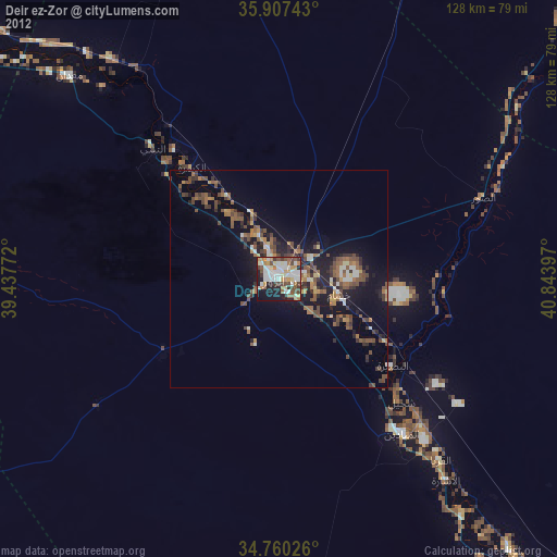
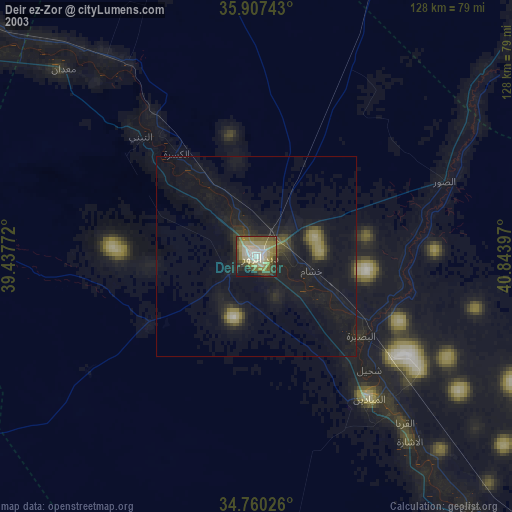
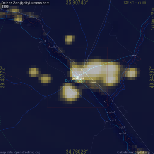
Deir ez-Zor night lights from space
Night Light of Deir ez-Zor from space (Syria) Src. Average luminocity for 10x10km area is 0.7234% and for 50x50km: 0.028%.
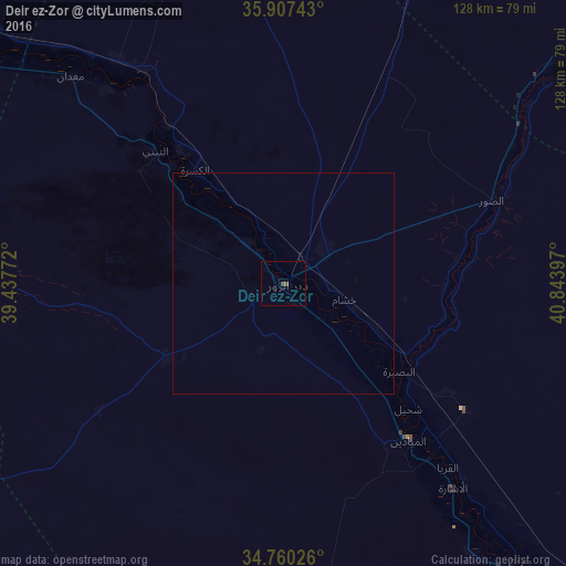
Analysis of Deir ez-Zor night lights 2016
Square area 10x10 km:
 0%
0%90-99
0%80-89
0%70-79
0%60-69
0%50-59
0%40-49
1.28%30-39
0.18%20-29
0%10-19
0%0-9
98.53%Square area 50x50 km:
0%90-99
0%80-89
0%70-79
0%60-69
0%50-59
0%40-49
0.05%30-39
0.01%20-29
0%10-19
0%0-9
99.94%Clear (daylight) street map image can be seen on geolist.org.
Map coordinates:
35° 54' 26.7" North, 39° 26' 15.8" East
35° 20' 9.2" North, 40° 8' 27" East
34° 45' 36.9" North, 40° 50' 38.3" East
Some cities around Deir ez-Zor sort by population:
• Ar Raqqah
123.2 km =76.6 mi,  303°
303°
• Ath Thawrah
154.4 km =95.9 mi,  291°
291°
• Al Ḩasakah
140.7 km =87.4 mi,  22°
22°
• Ālbū Kamāl
121.2 km =75.3 mi,  144°
144°
• Al Mayādīn
45.1 km =28 mi, 141°
• Ceylanpınar, TR
168.2 km =104.5 mi,  357°
357°
• Hajīn
95 km =59 mi, 138°
• Subaykhān
68 km =42.3 mi, 142°
170794 (p: 242,565)
Sources (retrieved 2019-11-25):
» NASA, Earths city lights 1995
» NASA city lights 2003
» Earth at Night: Flat Maps 2012, 2016