Ar Raqqah night lights from space
Night Light of Ar Raqqah (Ar-Raqqah) from space (Syria) Src. Average luminocity for 10x10km area is 14.3608% and for 50x50km: 0.648%.
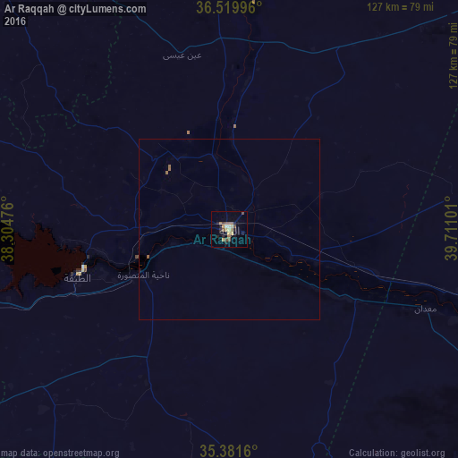
Analysis of Ar Raqqah night lights 2016
Square area 10x10 km:
 0%
0%90-99
1.47%80-89
1.28%70-79
3.85%60-69
2.2%50-59
3.3%40-49
2.93%30-39
0.37%20-29
4.4%10-19
4.03%0-9
76.19%Square area 50x50 km:
0%90-99
0.06%80-89
0.05%70-79
0.15%60-69
0.15%50-59
0.17%40-49
0.11%30-39
0.01%20-29
0.17%10-19
0.18%0-9
98.95%Clear (daylight) street map image can be seen on geolist.org.
Map coordinates:
36° 31' 11.9" North, 38° 18' 17.1" East
35° 57' 10.2" North, 39° 0' 28.4" East
35° 22' 53.8" North, 39° 42' 39.6" East
Some cities around Ar Raqqah sort by population:
• Deir ez-Zor
123.2 km =76.6 mi,  123°
123°
• Manbij
114.1 km =70.9 mi,  304°
304°
• Ath Thawrah
43.3 km =26.9 mi,  252°
252°
• ‘Ayn al ‘Arab
119.6 km =74.3 mi,  330°
330°
• Suruç, TR
125.1 km =77.7 mi,  335°
335°
• Akçakale, TR
84.5 km =52.5 mi,  356°
356°
• Dayr Ḩāfir
119.1 km =74 mi,  280°
280°
• Harran, TR
100.9 km =62.7 mi,  1°
1°
172955 (p: 177,636)
Sources (retrieved 2019-11-25):
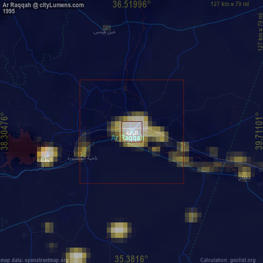
» NASA, Earths city lights 1995
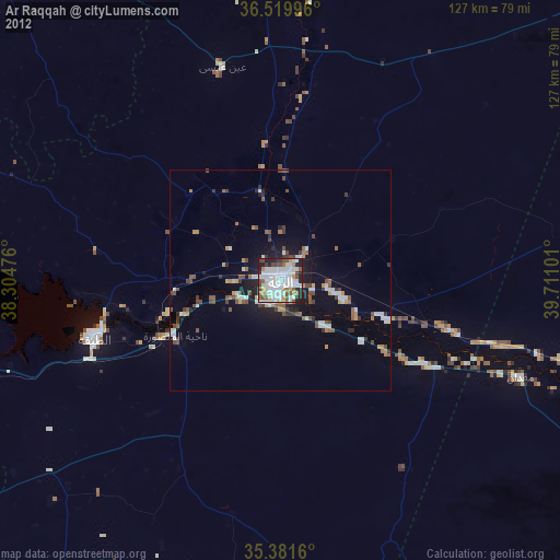
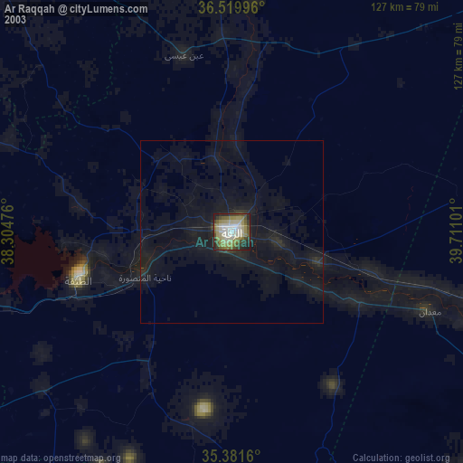
» NASA city lights 2003
» Earth at Night: Flat Maps 2012, 2016