Ath Thawrah night lights from space
Night Light of Ath Thawrah (Ar-Raqqah) from space (Syria) Src. Average luminocity for 10x10km area is 4.507% and for 50x50km: 0.223%.
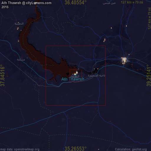
Analysis of Ath Thawrah night lights 2016
Square area 10x10 km:
 0%
0%90-99
0.7%80-89
1.75%70-79
0.87%60-69
0.17%50-59
0%40-49
0.7%30-39
0%20-29
2.8%10-19
0%0-9
93.01%Square area 50x50 km:
0%90-99
0.03%80-89
0.07%70-79
0.03%60-69
0.01%50-59
0.03%40-49
0.06%30-39
0%20-29
0.14%10-19
0.03%0-9
99.61%Clear (daylight) street map image can be seen on geolist.org.
Map coordinates:
36° 24' 19.9" North, 37° 50' 42.6" East
35° 50' 15.3" North, 38° 32' 53.8" East
35° 15' 55.9" North, 39° 15' 5.1" East
Some cities around Ath Thawrah sort by population:
• Ar Raqqah
43.3 km =26.9 mi,  72°
72°
• Al Bāb
110.1 km =68.4 mi,  302°
302°
• Manbij
93.4 km =58 mi,  325°
325°
• As Safīrah
109.1 km =67.8 mi,  284°
284°
• ‘Ayn al ‘Arab
118.4 km =73.6 mi,  351°
351°
• Tādif
107.6 km =66.9 mi, 301°
• Akçakale, TR
103.5 km =64.3 mi,  20°
20°
• Dayr Ḩāfir
83.5 km =51.9 mi, 295°
172374 (p: 87,880)
Sources (retrieved 2019-11-25):
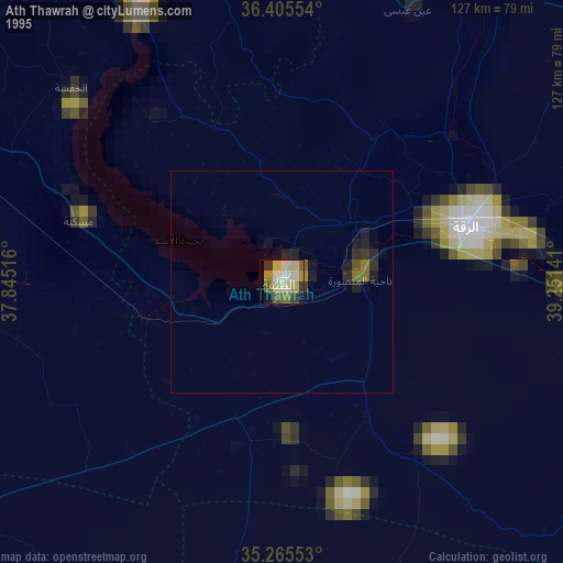
» NASA, Earths city lights 1995
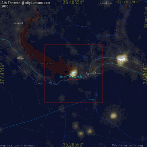
» NASA city lights 2003
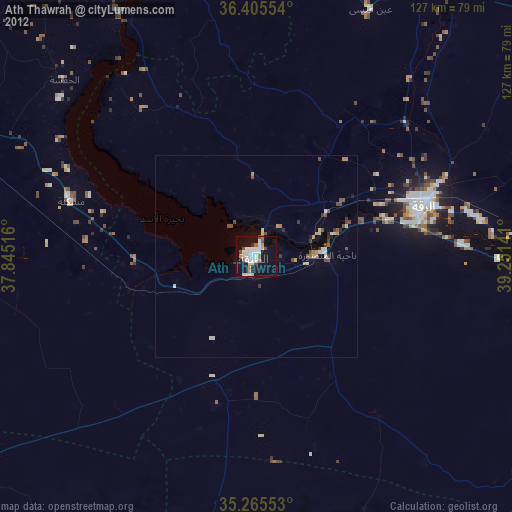
» Earth at Night: Flat Maps 2012, 2016