Chalatenango night lights from space
Night Light of Chalatenango from space (El Salvador) Src. Average luminocity for 10x10km area is 1.8918% and for 50x50km: 0.9167%.
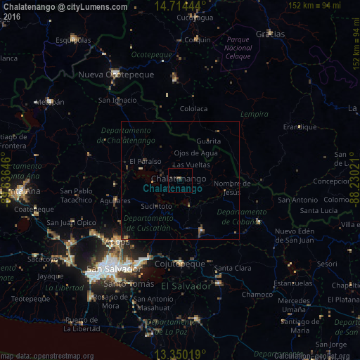
Analysis of Chalatenango night lights 2016
Square area 10x10 km:
 0%
0%90-99
0%80-89
0%70-79
0%60-69
0%50-59
1.73%40-49
0%30-39
0%20-29
1.95%10-19
0.65%0-9
95.67%Square area 50x50 km:
0.01%90-99
0.07%80-89
0.05%70-79
0.08%60-69
0.16%50-59
0.28%40-49
0.17%30-39
0.28%20-29
0.43%10-19
0.42%0-9
98.06%Clear (daylight) street map image can be seen on geolist.org.
Map coordinates:
14° 42' 52" North, 89° 38' 11.3" West
14° 1' 60" North, 88° 55' 60" West
13° 21' 0.7" North, 88° 13' 48.8" West
Some cities around Chalatenango sort by population:
• Apopa
36.6 km =22.7 mi,  226°
226°
• Cojutepeque
35.2 km =21.9 mi,  180°
180°
• San Martín
27.9 km =17.3 mi, 176°
• Aguilares
28.9 km =18 mi,  252°
252°
• Guazapa
31.2 km =19.4 mi,  236°
236°
• San Sebastián
35.1 km =21.8 mi,  162°
162°
• Tonacatepeque
34.4 km =21.4 mi,  215°
215°
• Suchitoto
14.7 km =9.1 mi, 223°
3587091 (p: 19,364)
Sources (retrieved 2019-11-25):
» Earth at Night: Flat Maps 2012, 2016