Cojutepeque night lights from space
Night Light of Cojutepeque (Cuscatlán) from space (El Salvador) Src. Average luminocity for 10x10km area is 8.4029% and for 50x50km: 5.9049%.
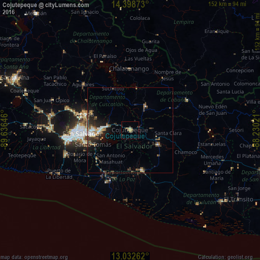
Analysis of Cojutepeque night lights 2016
Square area 10x10 km:
 0%
0%90-99
0%80-89
1.65%70-79
1.86%60-69
2.07%50-59
1.03%40-49
1.86%30-39
2.27%20-29
1.65%10-19
1.65%0-9
85.95%Square area 50x50 km:
0.45%90-99
0.79%80-89
0.68%70-79
0.49%60-69
0.72%50-59
1.18%40-49
1.26%30-39
1.44%20-29
2.22%10-19
3.05%0-9
87.74%Clear (daylight) street map image can be seen on geolist.org.
Map coordinates:
14° 23' 55.4" North, 89° 38' 11.3" West
13° 43' 0" North, 88° 55' 60" West
13° 1' 57.4" North, 88° 13' 48.8" West
Some cities around Cojutepeque sort by population:
• Soyapango
22.3 km =13.9 mi,  268°
268°
• San Vicente
17.1 km =10.6 mi,  122°
122°
• San Martín
7.6 km =4.7 mi,  13°
13°
• Ilopango
19.1 km =11.9 mi,  264°
264°
• Santiago Nonualco
22.3 km =13.9 mi,  184°
184°
• San Sebastián
11 km =6.8 mi,  80°
80°
• Tonacatepeque
21.3 km =13.2 mi,  289°
289°
• Apastepeque
17.1 km =10.6 mi,  108°
108°
3586977 (p: 48,411)
Sources (retrieved 2019-11-25):
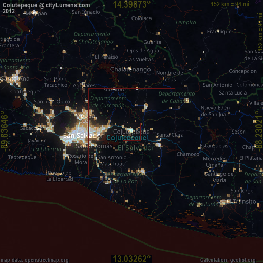
» Earth at Night: Flat Maps 2012, 2016