Apopa night lights from space
Night Light of Apopa (San Salvador) from space (El Salvador) Src. Average luminocity for 10x10km area is 38.7727% and for 50x50km: 14.7116%.
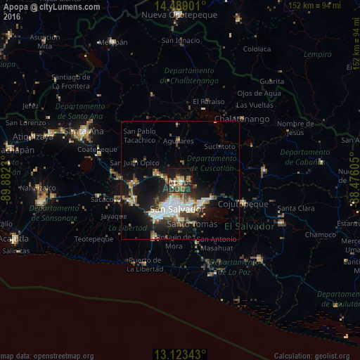
Analysis of Apopa night lights 2016
Square area 10x10 km:
 2.07%
2.07%90-99
2.69%80-89
3.93%70-79
11.16%60-69
7.64%50-59
6.82%40-49
6.4%30-39
9.3%20-29
14.05%10-19
26.24%0-9
9.71%Square area 50x50 km:
2.27%90-99
2.7%80-89
1.71%70-79
1.15%60-69
1.64%50-59
2.22%40-49
2.12%30-39
2.61%20-29
4.31%10-19
10.33%0-9
68.93%Clear (daylight) street map image can be seen on geolist.org.
Map coordinates:
14° 29' 20.4" North, 89° 52' 56.3" West
13° 48' 26" North, 89° 10' 45" West
13° 7' 24.3" North, 88° 28' 33.8" West
Some cities around Apopa sort by population:
• Soyapango
11.6 km =7.2 mi,  158°
158°
• Mejicanos
8.3 km =5.2 mi,  206°
206°
• Delgado
9.3 km =5.8 mi,  174°
174°
• Cuscatancingo
7.9 km =4.9 mi,  181°
181°
• Quezaltepeque
10.4 km =6.5 mi,  284°
284°
• Ayutuxtepeque
7.5 km =4.7 mi,  203°
203°
• Guazapa
7.8 km =4.8 mi,  4°
4°
• Tonacatepeque
7.2 km =4.5 mi,  113°
113°
3587345 (p: 112,158)
Sources (retrieved 2019-11-25):
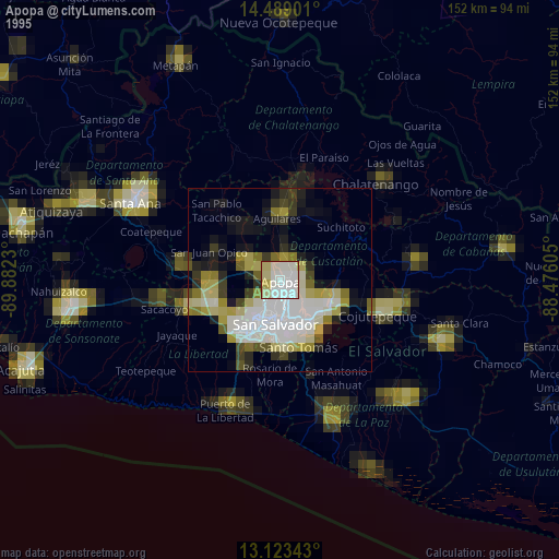
» NASA, Earths city lights 1995
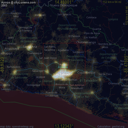
» NASA city lights 2003
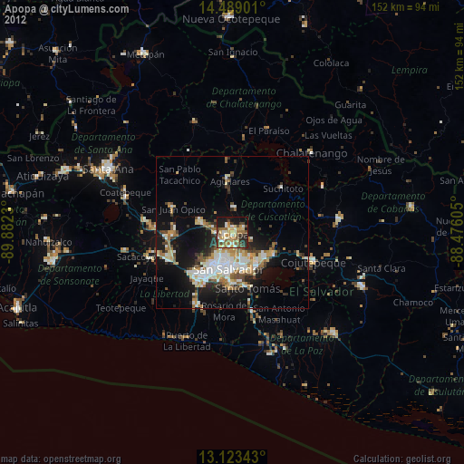
» Earth at Night: Flat Maps 2012, 2016