San Martín night lights from space
Night Light of San Martín (Cuscatlán) from space (El Salvador) Src. Average luminocity for 10x10km area is 0.8946% and for 50x50km: 4.4722%.
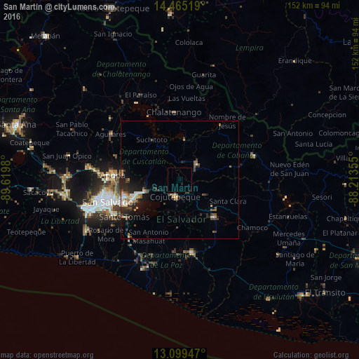
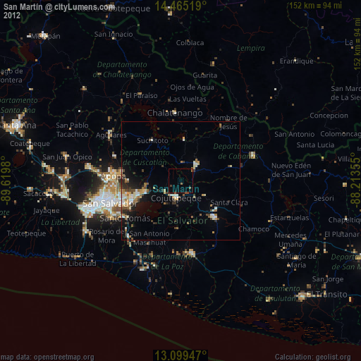
Analysis of San Martín night lights 2016
Square area 10x10 km:
 0%
0%90-99
0%80-89
0%70-79
0%60-69
0%50-59
0%40-49
0%30-39
0%20-29
0.83%10-19
0.83%0-9
98.35%Square area 50x50 km:
0.33%90-99
0.64%80-89
0.57%70-79
0.38%60-69
0.5%50-59
0.86%40-49
0.79%30-39
0.81%20-29
1.87%10-19
2.69%0-9
90.56%Clear (daylight) street map image can be seen on geolist.org.
Map coordinates:
14° 27' 54.7" North, 89° 37' 11.3" West
13° 46' 60" North, 88° 55' 0" West
13° 5' 58.1" North, 88° 12' 48.8" West
Some cities around San Martín sort by population:
• Soyapango
25.4 km =15.8 mi,  251°
251°
• Cojutepeque
7.6 km =4.7 mi,  193°
193°
• San Vicente
20.9 km =13 mi,  142°
142°
• Ilopango
22.7 km =14.1 mi, 246°
• San Sebastián
10.6 km =6.6 mi,  121°
121°
• Tonacatepeque
21.8 km =13.5 mi,  269°
269°
• Apastepeque
19.4 km =12.1 mi,  132°
132°
• Suchitoto
21 km =13 mi,  325°
325°
3583471 (p: 39,361)
Sources (retrieved 2019-11-25):
» Earth at Night: Flat Maps 2012, 2016