Aguilares night lights from space
Night Light of Aguilares (San Salvador) from space (El Salvador) Src. Average luminocity for 10x10km area is 4.3182% and for 50x50km: 6.5227%.
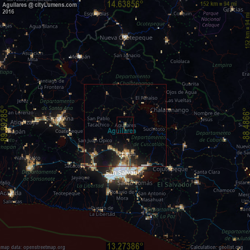
Analysis of Aguilares night lights 2016
Square area 10x10 km:
 0%
0%90-99
0%80-89
0%70-79
0.83%60-69
0.83%50-59
0.83%40-49
1.65%30-39
3.31%20-29
0.83%10-19
0%0-9
91.74%Square area 50x50 km:
0.29%90-99
0.54%80-89
0.76%70-79
0.83%60-69
0.99%50-59
1.33%40-49
1.1%30-39
1.69%20-29
2.58%10-19
5.59%0-9
84.31%Clear (daylight) street map image can be seen on geolist.org.
Map coordinates:
14° 38' 18.8" North, 89° 53' 34.3" West
13° 57' 26" North, 89° 11' 23" West
13° 16' 25.9" North, 88° 29' 11.8" West
Some cities around Aguilares sort by population:
• Apopa
16.7 km =10.4 mi,  176°
176°
• Quezaltepeque
16.6 km =10.3 mi,  212°
212°
• Ayutuxtepeque
23.6 km =14.7 mi, 184°
• Guazapa
9.1 km =5.7 mi,  168°
168°
• Nueva Concepción
22.9 km =14.2 mi,  328°
328°
• San Juan Opico
20.4 km =12.7 mi,  243°
243°
• Tonacatepeque
21 km =13 mi,  158°
158°
• Suchitoto
17.6 km =10.9 mi,  96°
96°
3587428 (p: 21,445)
Sources (retrieved 2019-11-25):
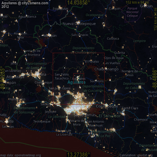
» Earth at Night: Flat Maps 2012, 2016